Channels Trail
| Channels Trail (log in to submit report) | |
|---|---|

| |
| Highlight | Although your likely goal, not the typical access |
| Park | The Channels Natural Area Preserve |
| Land Owner | Virginia Department of Forestry |
| Located | Rosedale, VirginiaLocation inherited from associated park |
| Trail Marking | Red blaze |
| Trail UseThings allowed to do on or near the trail | |
| FeaturesThings to see on or near the trail |
|
| Difficulty Rating | Hard |
| Hiking TimeTime from car and back. Includes any time hiking to access this trail. | 8 hrs for entire trail"hrsforentiretrail" is not declared as a valid unit of measurement for this property. round trip |
| Distance: | 5.50 mi8.851 km <br /> trailStrict non-repeating trail length / 11.0 mi17.703 km <br /> round tripTypical or shortest length from the car, hike the trail, and return to car |
| Trail Type | In-and-Out |
| Low / High Point | 1713 ft571 Yards <br />522.122 Meters <br /> / {{{High Point}}}"{{{High Point}}}" is not a number. |
| Elev. Gain/LossSee link for details of calculation. Gain/Loss is direction dependent. | {{{Elevation Gain}}}"{{{Elevation Gain}}}" is not a number. / ({{{Elevation Loss}}}"{{{Elevation Loss}}}" is not a number.) – South-to-North |
| Trip ReportsFrom user "hiked it" submissions<br />Recent is within last 90 days | 2 logged hikes (0 recent) |
| NearbyWithin 5 mi<br />Click link to view list | 146The following coordinate was not recognized: . trails / 145.8 mi of trail |
| Parking | Map |
| Trailhead | Map |
|
| |
| Show In Google Maps | |
Download KML / Upload new version / KML File Page / Create Profile Chart / gpsvisualizer Map
Trail Overview
How To Get There
Route Description
Typical Conditions
Fees, Permits, etc.
After the Hike
Miscellaneous Information
Gallery
-
Channels NAP boundary sign
-
Channels NAP information sign
-
Entrance sign on Brumley Gap Road
-
Channels top side enveloped in clouds
-
Trail Profile
-
Hayters Knob Firetower - Do not climb!
-
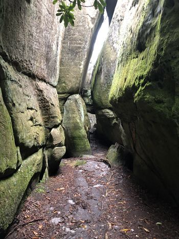
In The Channels
-
Locked Gate - Start of Shorter Hike
-
Signs at entrance for Channels spur trail


