Category:Images
Jump to navigation
Jump to search
This category uses the form Image. It is used to tag images on the site for trails or parks for later query in galleries and elsewhere.
Media in category "Images"
The following 200 files are in this category, out of 482 total.
(previous page) (next page) Lakeside Trailhead from Dam.jpg 600 × 450; 104 KB
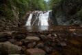
 Laurel Fork Gorge Falls.JPG 768 × 932; 287 KB
 Laurel Fork Gorge steps.JPG 768 × 1,024; 360 KB
 Laurel Run Trail creek.jpg 768 × 576; 175 KB
 Laurelforkfalls2.jpg 300 × 200; 20 KB
 Little stony creek falls profile.png 1,160 × 660; 22 KB
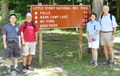 Little Stony Creek Falls trailhead sign.JPG 448 × 284; 104 KB
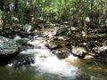 Little Stony Creek.JPG 1,024 × 768; 316 KB
 LittleStonyCreekFalls.jpg 640 × 480; 65 KB
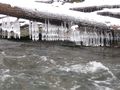
 LittleStonyFallsFrozen.jpg 640 × 480; 65 KB
 Locked Gate.JPG 4,032 × 3,024; 4.7 MB
 Lone Oak Trail Dosser sign.JPG 1,024 × 768; 334 KB
 Lone Oak Trail trailhead.JPG 480 × 640; 201 KB
 Looking North from Osborne Farm.JPG 4,320 × 1,964; 1.38 MB
 Lower Kiner Hollow Falls.jpg 768 × 1,024; 239 KB
 LRP Overlook Trail.jpg 640 × 480; 191 KB
 LRP Overlook.jpg 640 × 480; 81 KB
 Margarette falls 01.jpg 1,200 × 900; 620 KB
 Margarette Falls-profile.png 760 × 460; 22 KB
 Middle Falls Little Stony Creek.JPG 775 × 768; 276 KB
 Molly's knob trail profile.png 1,160 × 660; 24 KB
 Mountain Laurel.JPG 4,204 × 2,920; 2.3 MB
 Mountains of the Roan highlands.jpg 2,816 × 2,112; 1.91 MB
 MtRogersSign.jpg 1,200 × 1,600; 580 KB
 NC-VA-TN Corner triangulation station disk.jpg 600 × 450; 83 KB
 NickGrindstaff.jpg 768 × 1,024; 287 KB
 Observation Tower Steps.jpeg 2,048 × 1,536; 1.83 MB
 OldAppleOrchard.jpg 800 × 600; 299 KB
 OsborneTract.jpg 1,600 × 1,200; 542 KB
 OverhangingRock.jpg 800 × 600; 275 KB
 Panther Creek Main Entrance Sign.jpg 412 × 268; 37 KB
 Pawpaw profile.png 1,160 × 660; 21 KB
 PCSP Lost Road Trail - another trail junction sign.JPG 4,032 × 3,024; 5.76 MB
 PCSP Lost Road Trail - first junction with Maple Arch Trail.JPG 4,032 × 3,024; 4.52 MB
 PCSP Lost Road Trail - trail junction sign.JPG 4,032 × 3,024; 5.83 MB
 PCSP Maple Arch Trail - another beach view.JPG 4,032 × 3,024; 3.16 MB
 PCSP Maple Arch Trail - first beach.JPG 4,032 × 3,024; 2.69 MB
 PCSP Maple Arch Trail - sign at loop split.JPG 4,032 × 3,024; 6.33 MB
 PCSP Maple Arch Trail - slowly crossing the path.JPG 4,032 × 3,024; 5.7 MB
 PCSP Norris Blackburn Trail - disc golf.JPG 3,024 × 4,032; 5.82 MB
 PCSP Norris Blackburn Trail - hiking trail marker.JPG 3,024 × 4,032; 5.37 MB
 PCSP Norris Blackburn Trail - intersection sign.JPG 4,032 × 3,024; 5.94 MB
 PCSP Norris Blackburn Trail - wildlife observatory.JPG 4,032 × 3,024; 6.43 MB
 PCSP Ore Mine intersection sign.JPG 4,032 × 3,024; 4.73 MB
 PCSP Ore Mine lower path.JPG 3,024 × 4,032; 4.27 MB
 PCSP Ore Mine Trail - Bench.JPG 3,024 × 4,032; 4.88 MB
 PCSP Ore Mine Trail - View thru trees.JPG 3,024 × 4,032; 4.1 MB
 PCSP Point Lookout Trail - 0.50 MI sign.JPG 4,032 × 3,024; 6.9 MB
 PCSP Point Lookout Trail - bench.JPG 3,024 × 4,032; 7.08 MB
 PCSP Point Lookout Trail - Cherokee Lake1.JPG 4,032 × 3,024; 5.61 MB
 PCSP Point Lookout Trail - Cherokee Lake2.JPG 4,032 × 3,024; 2.49 MB
 PCSP Point Lookout Trail - overlook.JPG 3,024 × 4,032; 4.49 MB
 PCSP Point Lookout Trail - spur trail sign.JPG 4,032 × 3,024; 7.89 MB
 PCSP Point Lookout Trail Profile.png 1,160 × 660; 20 KB
 PCSP Ridge Crest Trail Profile.png 1,160 × 660; 22 KB
 PCSP Road to Recycling Trail - bridge.JPG 4,032 × 3,024; 6.01 MB
 PCSP Road to Recycling Trail - last info sign remaining.JPG 3,024 × 4,032; 3.95 MB
 PCSP Seven Sinkholes Trail - Another Sinkhole.JPG 3,024 × 4,032; 3.94 MB
 PCSP Seven Sinkholes Trail - Sinkhole 1.JPG 3,024 × 4,032; 7.02 MB
 Peg Leg Mine history.jpg 576 × 768; 89 KB
 Peg leg mine profile.png 1,160 × 660; 23 KB
 Phipps Bend End of Trail.png 504 × 378; 553 KB
 Phipps Bend Lillypad Pond.jpg 4,032 × 3,024; 5.49 MB
 Phipps Bend Trail - deer.jpg 456 × 369; 68 KB
 Phipps Bend Trail - near trail end.jpg 600 × 450; 80 KB
 Phipps bend trail profile.png 1,160 × 660; 18 KB
 Pine trail profile.png 1,160 × 660; 22 KB
 Pipestem Entrance.jpg 514 × 768; 96 KB
 Plaque on Houston Ridge for Stan Murray.JPG 1,024 × 752; 342 KB
 PotatoTop.jpg 1,600 × 1,200; 419 KB
 Raider's run trail profile.png 1,160 × 660; 23 KB
 Rattlesnake Ridge Trailhead.jpg 799 × 768; 351 KB
 Raven rock profile.png 1,160 × 660; 23 KB
 Ridge top profile.png 1,160 × 660; 21 KB
 Riverside profile.png 1,160 × 660; 23 KB
 RMSP Ridge Top Trail.jpg 1,280 × 960; 362 KB
 Roan Bridge over Doe River.jpg 1,280 × 960; 323 KB
 Roan Cabin Playground.JPG 2,816 × 2,112; 3.04 MB
 Roan Chestnut Miller Trail head.jpg 2,816 × 2,112; 2.49 MB
 Roan Forest Road and Turkey Trot.jpg 1,280 × 720; 170 KB
 Roan Forest Road Purple Blaze.jpg 2,322 × 4,128; 2.88 MB
 Roan Forest Road Trail Head at Visitors Center.jpg 2,816 × 2,112; 2.99 MB
 Roan Fred Behrend large rock.jpg 2,816 × 2,112; 2.99 MB
 Roan Fred Behrend Memorial.jpg 2,816 × 2,112; 3.1 MB
 Roan Fred Behrend stream bridge.jpg 2,816 × 2,112; 2.73 MB
 Roan Fred Behrend Trail Head sign.jpg 2,816 × 2,112; 2.66 MB
 Roan intersection of Chestnut and Forest Road.jpg 2,816 × 2,112; 3.55 MB
 Roan Miller Homestead.jpg 3,072 × 2,304; 3.38 MB
 Roan Mountain Park Sign.jpg 1,280 × 960; 336 KB
 Roan Mystery Mountain Trail Monster.jpg 576 × 1,024; 146 KB
 Roan New Camp Playground.JPG 2,816 × 2,112; 2.97 MB
 Roan Pavilion.JPG 3,648 × 2,736; 2.17 MB
 Roan Peg Leg mine entrance.jpg 1,024 × 768; 200 KB
 Roan Peg Leg view from platform.jpg 1,024 × 768; 229 KB
 Roan Raven Rock on the trail.jpg 1,280 × 960; 244 KB
 Roan sign about the wetlands.jpg 1,280 × 960; 209 KB
 Roan Ted Gray Post 1.jpg 960 × 1,280; 293 KB
 Roan Ted Gray Post 10.jpg 1,280 × 960; 369 KB
 Roan Ted Gray Post 11.jpg 1,280 × 960; 348 KB
 Roan Ted Gray Post 2.jpg 960 × 1,280; 260 KB
 Roan Ted Gray Post 3.jpg 1,280 × 960; 350 KB
 Roan Ted Gray Post 4.jpg 960 × 1,280; 252 KB
 Roan Ted Gray Post 5.jpg 1,280 × 960; 328 KB
 Roan Ted Gray Post 6.jpg 960 × 1,280; 346 KB
 Roan Ted Gray Post 7.jpg 1,280 × 960; 321 KB
 Roan Ted Gray Post 8.jpg 1,280 × 960; 311 KB
 Roan Ted Gray Post 9.jpg 1,280 × 960; 305 KB
 Roan Ted Gray swim area.jpg 1,280 × 960; 272 KB
 Roan Ted Gray Trail View.jpg 960 × 1,280; 305 KB
 Roan tent only site.jpg 4,128 × 2,322; 5.53 MB
 Roan Turkey Trot sign.jpg 1,095 × 870; 579 KB
 Roan Turkey Trot Trail.jpg 576 × 1,024; 144 KB
 Roan view from Miller cemetery platform.jpg 2,816 × 2,112; 1.06 MB
 Roan View from Raven Rock.jpg 1,280 × 960; 266 KB
 Roan Water Wheel.jpg 2,816 × 2,112; 3.36 MB
 Roaring Branch Trail - first creek crossing.JPG 1,928 × 2,572; 1.21 MB
 Roaring Branch Trail - stone steps.JPG 1,154 × 2,086; 507 KB
 Roaring Branch Trail - view from High Butte.JPG 448 × 336; 47 KB
 Roaring Branch Trail - View of Stone Mountains from High Butte.JPG 1,024 × 364; 59 KB
 Roaring Branch Trail - wading creek crossing.JPG 448 × 287; 59 KB
 Roaring Branch Trail - wide creek crossing.JPG 2,572 × 1,928; 1.01 MB
 Roaring Branch Trail - yet another creek crossing.JPG 448 × 336; 67 KB
 Roaring branch trail profile.png 1,160 × 660; 22 KB
 Roaring Branch Trailhead.JPG 1,430 × 2,572; 1.07 MB
 Roaring Branch waterfall.JPG 1,928 × 2,572; 1.07 MB
 RoaringForkValley.jpg 800 × 544; 145 KB
 Rock Creek Falls.jpg 900 × 1,200; 420 KB
 RockCreekFalls.jpg 2,592 × 1,944; 2.55 MB
 Rogers Ridge ATV sign.jpg 768 × 1,024; 96 KB
 Rogers Ridge Balds Hiking.jpg 1,280 × 960; 254 KB
 Rogers Ridge Balds View 1.jpg 1,280 × 960; 233 KB
 Rogers Ridge Balds View 2.jpg 1,280 × 960; 241 KB
 Rogers Ridge Balds View 3.jpg 1,280 × 960; 242 KB
 Rogers Ridge Balds View 4.jpg 1,280 × 960; 234 KB
 Rogers Ridge Blaze.jpg 768 × 1,024; 166 KB
 Rogers Ridge Hitching Posts.jpg 1,280 × 960; 310 KB
 Rogers Ridge Initial Stream crossing.jpg 1,280 × 960; 298 KB
 Rogers Ridge Possible Terminus.jpg 768 × 1,024; 184 KB
 Rogers Ridge Rocky Trail.jpg 768 × 1,024; 220 KB
 Rogers Ridge Trail Head.jpg 1,280 × 960; 323 KB
 Rogers Ridge Trail View 1.jpg 768 × 1,024; 236 KB
 Rogers Ridge Trail View 2.jpg 768 × 1,024; 291 KB
 Rogers Ridge Whitetop and Mt Rogers.jpg 1,280 × 960; 286 KB
 Sampson Sign At Squibb Creek.jpg 768 × 1,024; 124 KB
 Sand Cave 200809 group photo.jpg 640 × 480; 57 KB
 Sand Cave 200809 view into.jpg 640 × 480; 73 KB
 SandCave.JPG 1,200 × 900; 205 KB
 ShookBranchBridge.jpg 606 × 529; 176 KB
 Shore view from lake.jpg 640 × 480; 105 KB
 Sill Branch Falls 2.jpg 576 × 1,024; 175 KB
 Sill Branch Falls.jpg 576 × 1,024; 151 KB
 Sill branch profile.png 1,160 × 660; 22 KB
 Sill Branch Trail Head.jpg 1,280 × 720; 196 KB
 Sinking Waters information sign.jpg 768 × 576; 123 KB
 Sinking waters profile.png 1,160 × 660; 25 KB
 Sinking Waters sinkhole.jpg 2,048 × 1,536; 910 KB
 Sinking waters sunk.jpg 4,032 × 3,024; 4.89 MB
 Smallman Area Overlook.JPG 4,032 × 3,024; 2.62 MB
 Spivey gap - flower-white rhododendron.jpg 781 × 586; 69 KB
 Spivey gap - no business knob shelter.jpg 432 × 299; 22 KB
 Spivey gap - nolichucky river gorge.jpg 781 × 586; 90 KB
 Spivey gap - view from temple hill ridge 2.jpg 1,024 × 768; 233 KB
 Spivey gap - view from temple hill ridge.jpg 768 × 1,024; 234 KB
 Spur trail sign.JPG 3,024 × 4,032; 4.09 MB
 Squibb Creek Bridge.jpg 1,280 × 960; 319 KB
 Squibb Creek Cabin.jpg 1,280 × 960; 242 KB
 Squibb Creek Crossing.jpg 1,280 × 960; 221 KB
 Squibb Creek Falls profile.png 1,160 × 660; 22 KB
 Squibb Creek Fungus.jpg 1,280 × 960; 125 KB
 Squibb Creek Salamander.jpg 1,280 × 960; 245 KB
 Squibb Creek Sign.jpg 1,280 × 960; 182 KB
 Squibb Creek trail bridge.jpg 1,280 × 960; 250 KB
 Squibb Falls.jpg 768 × 1,024; 162 KB
 Steele Creek Park.jpg 1,000 × 667; 505 KB
 Stream view along trail.JPG 3,024 × 4,032; 5.29 MB
 Sweet gum trail profile.png 1,160 × 660; 23 KB
 Table rock summit trail profile.png 1,160 × 660; 23 KB
 The Channels Natural Area Preserve Top View.jpg 1,348 × 900; 515 KB
 The Great Channels1.jpg 768 × 1,024; 139 KB
 To Fall Creek Loop Trail.jpg 265 × 351; 29 KB
 Tom gray profile.png 1,160 × 660; 22 KB
 Tower Ridge Trail.JPG 768 × 1,024; 325 KB
 Towhee trail profile.png 1,160 × 660; 23 KB
 Trail intersection.jpg 640 × 480; 165 KB
 Trail Markers.JPG 3,024 × 4,032; 5.68 MB
 Trailhead signpost.JPG 3,024 × 4,032; 5.1 MB
 Turkey trot profile.png 1,160 × 660; 20 KB
 Upper Falls Little Stony Creek.JPG 768 × 1,024; 280 KB
 Upper Falls of Little Stony Creek.jpg 385 × 450; 55 KB
 VCT - Green Cove station.JPG 1,024 × 625; 145 KB
 View from ChimneyTop.jpg 600 × 450; 169 KB
 View from Rattlesnake Ridge.JPG 640 × 480; 148 KB
 View from White House Cliffs1.JPG 448 × 336; 86 KB
 View from White House Cliffs2.JPG 448 × 336; 90 KB
 View from White House Cliffs3.JPG 448 × 308; 89 KB
 View of Roan Cloudland Trail.jpg 2,736 × 3,648; 2.23 MB
 View of Squibb Creek.jpg 768 × 1,024; 176 KB
 View of the Roan water wheel.jpg 1,024 × 768; 111 KB
 Virginia Creeper Trail - Abingdon Trailhead.jpg 768 × 576; 145 KB
 Virginia Creeper Trail - Alvarado Station.jpg 768 × 1,024; 180 KB


