Tower Ridge Trail
| |||||||||||||||||||||||||||||||||||||||||||||
Trail Overview
Located in Buffalo Mountain Park, this trail offers an alternative hiking route up to the communication towers area.
How to get there
Refer to the “How to get there” instructions on the Buffalo Mountain Park page. Take the gravel road left to the alternative parking area. The actual lower trailhead is reached from the White Rock Trail by either heading into Hartsell Hollow or heading up the steep gravel service road.
Route Description
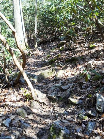
The blue blazed Tower Ridge Trail travels between two junctions with the White Rock Trail. The lower trailhead is in the power line right-of-way, while the upper trailhead is behind the communication towers. The steep and narrow trail follows the ridgeline to the west of the service road. At the upper end, it briefly connects to and travels the service road.
A roughly three mile loop hike can be done in couple of hours (plus stops) by hiking up the Tower Ridge Trail and returning by the White Rock Trail. The latter offers views to the east of the I-26 valley.
Typical Conditions
The blue blazes were recently repainted, thus the route is clear once on this trail. It is a narrow and steep path winding along the ridgeline through rhododendron and small trees. Views to the north can be had when the leaves are down. Watch out for the many briars growing along the trail!
This area was not affected by the 2008 fire.
Misc. Information
Maps
Tower Ridge Trail is the blue line, while White Rock Trail is in black.
Note: The route for Highridge Road is incorrect as the service road is closed with a gate.
Photos
- Placeholder.jpg
