Horse Creek Recreation Area: Difference between revisions
Jump to navigation
Jump to search
(tweaks using form) |
(try new map zoom) |
||
| Line 18: | Line 18: | ||
|Main Location=36.10562, -82.65409 | |Main Location=36.10562, -82.65409 | ||
}} | }} | ||
{{Park trail map}} | {{Park trail map|Zoom=16}} | ||
__TOC__ | __TOC__ | ||
Revision as of 08:27, 9 May 2020
| Horse Creek Recreation Area | |
|---|---|

| |
| Park Type | Recreation Area |
| Located | Chuckey, Tennessee |
| External Links | Official Website |
| Entrance Fee | None |
| ActivitiesThings to do at the park | |
| Park AmenitiesThings built to enjoy or use at the park | |
| FeaturesNatural things to see at the park | |
| Park Trails |
1 Trails / Total of 2.53 miles4.072 km <br /> |
| Lodging Types | |
| Camping Amenities | |
| Park Area | |
| Operated By | Cherokee National Forest |
| Main Location | 36° 6' 20.23" N, 82° 39' 14.72" W Map |
|
| |
| Show In Google Maps | |
Park Overview
Forest Service Recreation Area. Offering secluded camping and great trails.
Directions
Park Trails
The park offers the following trails to explore:
| Park Trails | Distance | Difficulty | Marking | Usage | Highlight |
|---|---|---|---|---|---|
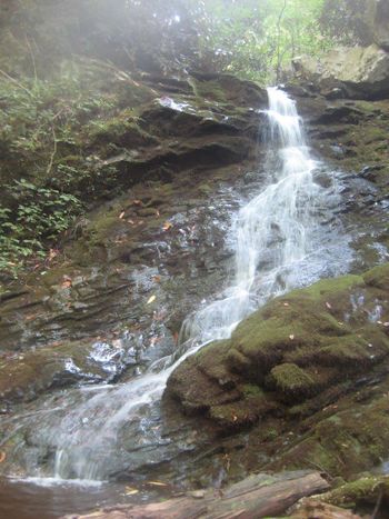
| Squibb Creek Falls | 2.53 mi | Medium | None | A delightful blend of creek walking and forest walking to a great waterfall |
I have names of the following trails, but not even enough information to create the stub.
- Middle Spring Ridge Trail, #4
- Turkey Pen Cove Trail, #15
- Horse Creek Trail(??)
- Pete's Branch Trail (??)
