File:Mountains of the Roan highlands.jpg: Difference between revisions
Jump to navigation
Jump to search
(Horizon map of the Roan Highlands as viewed from the viewing platform at Chestnut Ridge at the Miller Homestead cemetery.) |
mNo edit summary |
||
| Line 1: | Line 1: | ||
Horizon map of the Roan Highlands as viewed from the viewing platform at Chestnut Ridge at the Miller Homestead cemetery. | Horizon map of the Roan Highlands as viewed from the viewing platform at Chestnut Ridge at the Miller Homestead cemetery. | ||
{{Image | |||
|File name=Mountains of the Roan highlands.jpg | |||
|Trail=Chestnut Ridge | |||
|Caption=Roan Highlands Horizon Map | |||
}} | |||
Latest revision as of 22:37, 18 December 2019
Horizon map of the Roan Highlands as viewed from the viewing platform at Chestnut Ridge at the Miller Homestead cemetery.
| Trail | Chestnut Ridge |
|---|---|
| Park | |
| Caption | Roan Highlands Horizon Map |
File history
Click on a date/time to view the file as it appeared at that time.
| Date/Time | Thumbnail | Dimensions | User | Comment | |
|---|---|---|---|---|---|
| current | 20:38, 19 September 2015 | 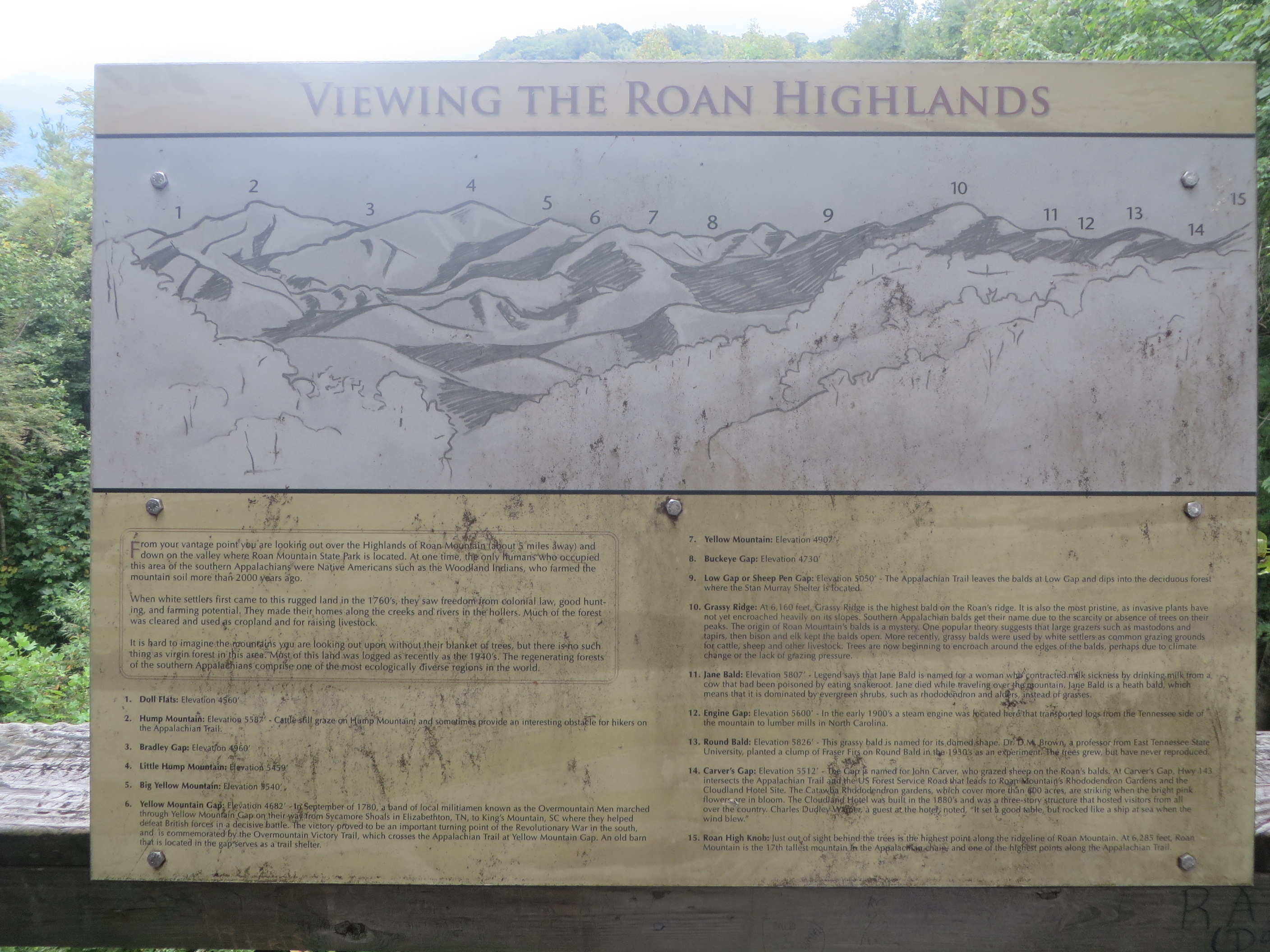 | 2,816 × 2,112 (1.91 MB) | Tim (talk | contribs) | Horizon map of the Roan Highlands as viewed from the viewing platform at Chestnut Ridge at the Miller Homestead cemetery. |
You cannot overwrite this file.
File usage
There are no pages that use this file.