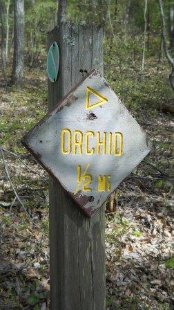
Orchid Trail: Difference between revisions
Jump to navigation
Jump to search
(convert to new trail form template) |
(tweaks using form) |
||
| Line 1: | Line 1: | ||
{{Trail | {{Trail | ||
|Banner Image=File: | |Banner Image=File:BMP Orchid Trail sign.JPG | ||
|Park=Bays Mountain Park | |Park=Bays Mountain Park | ||
|Land Owner=City of Kingsport | |Land Owner=City of Kingsport | ||
|Trail Marking=Signs | |Trail Marking=Signs | ||
|Trail Use=Hiking, Geocaching | |Trail Use=Hiking, Geocaching | ||
|Trail Features= | |Trail Features=Mountains | ||
|Difficulty Rating=Medium | |Difficulty Rating=Medium | ||
|Hike Time= | |Hike Time=45 min | ||
|Trail Distance= | |Trail Distance=0.265 mi | ||
|Round Trip Distance= | |Round Trip Distance=1.8 mi | ||
|Trail Type= | |Trail Type=Segment | ||
|High Point= | |High Point=2,161 ft | ||
|Low Point=1, | |Low Point=1,845 ft | ||
|Elevation Gain= | |Elevation Gain=315 ft | ||
|Elevation Loss= | |Elevation Loss=2 ft | ||
|Elevation Change Direction= | |Elevation Change Direction=North-to-South | ||
|Parking location=36.50882, -82.60955 | |Parking location=36.50882, -82.60955 | ||
|Trailhead location=36. | |Trailhead location=36.50353, -82.61894 | ||
}} | }} | ||
{{Trail Map|Other Trails=Lake Road (Bays Mountain Park),Bays Ridge Road}} | {{Trail Map|Other Trails=Lake Road (Bays Mountain Park),Bays Ridge Road}} | ||
| Line 31: | Line 30: | ||
== Route Description== | == Route Description== | ||
[[File:Orchid trail profile.png|thumb|right]] | |||
Short 0.4 mile connecting trail with many switchback through a hollow between the two park roads [[Trail connects to::Lake Road (Bays Mountain Park)|Lake Road]] and [[Trail connects to::Bays Ridge Road]]. | Short 0.4 mile connecting trail with many switchback through a hollow between the two park roads [[Trail connects to::Lake Road (Bays Mountain Park)|Lake Road]] and [[Trail connects to::Bays Ridge Road]]. | ||
Latest revision as of 18:17, 15 December 2019
| Orchid Trail (log in to submit report) | |
|---|---|

| |
| Park | Bays Mountain Park |
| Land Owner | City of Kingsport |
| Located | Kingsport, TennesseeLocation inherited from associated park |
| Trail Marking | Signs |
| Trail UseThings allowed to do on or near the trail | |
| FeaturesThings to see on or near the trail | |
| Difficulty Rating | Medium |
| Hiking TimeTime from car and back. Includes any time hiking to access this trail. | 45 min0.75 Hours <br />0.0469 Days <br /> round trip |
| Distance: | 0.265 mi0.426 km <br /> trailStrict non-repeating trail length / 1.8 mi2.897 km <br /> round tripTypical or shortest length from the car, hike the trail, and return to car |
| Trail Type | Segment |
| Low / High Point | 1,845 ft615 Yards <br />562.356 Meters <br /> / 2,161 ft720.333 Yards <br />658.673 Meters <br /> |
| Elev. Gain/LossSee link for details of calculation. Gain/Loss is direction dependent. | 315 ft96.012 Meters <br /> / (2 ft0.61 Meters <br />) – North-to-South |
| Trip ReportsFrom user "hiked it" submissions<br />Recent is within last 90 days | No hikes logged yet |
| NearbyWithin 5 mi<br />Click link to view list | 30 trails / 38.2 mi of trail |
| Parking | 36° 30' 31.75" N, 82° 36' 34.38" W Map |
| Trailhead | 36° 30' 12.71" N, 82° 37' 8.18" W Map |
|
| |
| Show In Google Maps | |
Download KML / Upload new version / KML File Page / Create Profile Chart / gpsvisualizer Map
Trail Overview[edit]
Located in Bays Mountain Park. Trail between Lake Road and Bays Ridge Road down a hollow. Not certain if wild orchids can be seen along trail.
How to get there[edit]
The trail is not directly accessible from the main parking lot. Cross the dam and take either Follow Lake Road or Bays Ridge Road until a trail sign is seen.
Route Description[edit]
Short 0.4 mile connecting trail with many switchback through a hollow between the two park roads Lake Road and Bays Ridge Road.
| Miles | Orchid Trail | Miles | Elevation (ft) |
|---|---|---|---|
| 0.0 | Trailhead at Lake Road | 0.4 | 1847 |
| 0.4 | Trailhead at Bays Ridge Road | 0.0 | 2156 |
Typical Conditions[edit]
Lesser used trail, thus dirt path well covered with fallen leaves. A few stone steps have been built long time ago.
Regulations[edit]
NO BIKES!
