Elk River Big Falls: Difference between revisions
Jump to navigation
Jump to search
| Line 42: | Line 42: | ||
== How to get there == | == How to get there == | ||
<!-- Please enter detailed instruction on how to find the trail head. --> | <!-- Please enter detailed instruction on how to find the trail head. --> | ||
The trailhead is located at the end of Elk River road just off Highway 19E. From Highway 19E, just before you cross into Tennessee, turn on Old Mill Rd. Look for Elk River Road and take it till it ends. | |||
== Route Description== | == Route Description== | ||
Revision as of 06:59, 13 September 2017
| |||||||||||||||||||||||||||||||||||||
Trail Overview
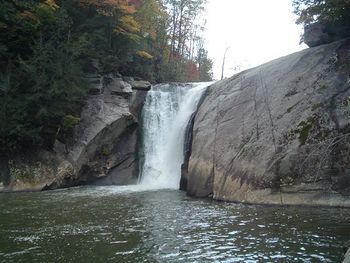
A short 10 minute moderate walk to an impressive 50ft North Carolina waterfall.
How to get there
The trailhead is located at the end of Elk River road just off Highway 19E. From Highway 19E, just before you cross into Tennessee, turn on Old Mill Rd. Look for Elk River Road and take it till it ends.
Route Description
Typical Conditions
Fees, Permits, etc.
After the Hike
Misc. Information
Maps
Photos
- Placeholder.gif
