Julian Price Memorial Park: Difference between revisions
(→Maps: Updating for new Maps extension - removed pins with no coords(?!) and non-existent kml(?!)) |
(add needs) |
||
| Line 1: | Line 1: | ||
<!-- The following few lines create the "Infobox" table template. Please scroll down to edit the main content of the article. --> | <!-- The following few lines create the "Infobox" table template. Please scroll down to edit the main content of the article. | ||
{{Infobox Trail | |||
-->{{Infobox Trail | |||
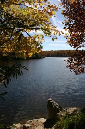
| Image Name = Julian Price Lake.jpg | | Image Name = Julian Price Lake.jpg | ||
| City = Blowing Rock | | City = Blowing Rock | ||
| Line 14: | Line 15: | ||
| Longitude = -81.731497 | | Longitude = -81.731497 | ||
| Medical = Blowing Rock, NC | | Medical = Blowing Rock, NC | ||
}} | }}<!-- | ||
<!-- End Infobox template table | |||
End Infobox template table | |||
<!-- | -->{{Trail page needs | ||
| Hide needs = | |||
| KML = | |||
| Updated KML = | |||
| Detail route description = | |||
| Photos = | |||
| Winter photos = | |||
| Remove prefix = | |||
| Update infobox = | |||
| Infobox data update = | |||
| Trail pins = | |||
| Other = Not a trail | |||
| Comment = Change to park page and make trail pages | |||
| Date reviewed = | |||
}}<!-- | |||
Start of Main Page --> | |||
== Trail Overview == | == Trail Overview == | ||
<!-- Enter a overview of the trail. What attracts you to this trail, points of interest, types of flowers, lakes, and peaks that you see along the way. --> | <!-- Enter a overview of the trail. What attracts you to this trail, points of interest, types of flowers, lakes, and peaks that you see along the way. --> | ||
Revision as of 21:03, 29 October 2015
| |||||||||||||||||||||||||||||||||||||
Trail Overview
4200 acre park at the foot of Grandfather Mountain along Blue Ridge Parkway.
How to get there
From Johnson City, TN
- Take US19E over to Elk Park, NC.
- Continue onto NC194 for about six miles to Newland, NC.
- Turn each on NC181 and travel four miles to Linville, NC.
- Take either US221 Blowing Rock Highway or Roseboro Road over the Blue Ridge Parkway.
- Proceed north on BRP to mile marker 297.
The lake is south of BRP, while the picnic area is to the north.
Route Description
The park offers several trails for your enjoyment.
| Trail | Miles | Blaze | Difficulty | Usage |
|---|---|---|---|---|
| Green Knob Trail | 2.3 loop | Medium | ||
| Boone Fork Trail | 5.5 loop | Medium | ||
| Price Lake Trail | 2.7 loop | Easy | ||
| Tanawha Trail | 12.5 straight | Difficult |
Recommended starting point for the Price Lake loop trail is at the dam, crossing it and proceeding clockwise around the lake. The Boone Fork loop trail is accessed from the picnic area with recommendation that it is easier to follow clockwise. The Tanawha Trail along Grandfather Mountain passes under the Linn Cove Viaduct - and is part of Section 13 on the Mountains-to-Sea Trail. Parking for Green Knob loop trail is at MM296 and 295.5.
Typical Conditions
The dirt path trails are in excellent condition as maintained by the National Park Service. Expect crowds during peak leaf season in October. Some wet spots have been reported on the Price Lake loop trail - especially after wet weather.
Fees, Permits, etc.
No permit or fee required to hike. Fishing will require a North Carolina license. The sites at the park campground are available for $16/night. During the summer, canoes can be rented at $12 for first hour and $10 for each additional hour to paddle on the 47 acre Price Lake.
After the Hike
Misc. Information
Maps
Photos
- Placeholder.jpg
