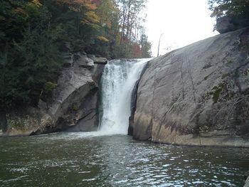
Elk River Big Falls: Difference between revisions
Jump to navigation
Jump to search
No edit summary |
No edit summary |
||
| Line 10: | Line 10: | ||
| Elevation Gain = * | | Elevation Gain = * | ||
| High Point = * | | High Point = * | ||
| Latitude = 36. | | Latitude = 36.1987 | ||
| Longitude = -81. | | Longitude = -81.9695 | ||
| Medical = *, TN | | Medical = *, TN | ||
<!-- DON'T EDIT THE GOOGLEMAP TAG --> | <!-- DON'T EDIT THE GOOGLEMAP TAG --> | ||
| googlemap = | | googlemap = | ||
<googlemap lat="36. | <googlemap lat="36.1987" lon="-81.9695" zoom="9" width="270" type="map" height="180" selector="no" controls="small"> | ||
36. | 36.1987, -81.9695,Elk River Big Falls | ||
</googlemap> | </googlemap> | ||
}} | }} | ||
Revision as of 10:55, 23 May 2011
| |||||||||||||||||||||||||||||||||||||
Trail Overview
How to get there
Route Description
Typical Conditions
Fees, Permits, etc.
After the Hike
Misc. Information
Maps
Photos
- Placeholder.gif
