Max Patch: Difference between revisions
Jump to navigation
Jump to search
(Created page with "<!-- The following few lines create the "Infobox" table template. Please scroll down to edit the main content of the article. --> {{Infobox Trail | Image Na...") |
No edit summary |
||
| Line 2: | Line 2: | ||
{{Infobox Trail | {{Infobox Trail | ||
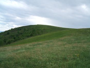
| Image Name = Max_Patch.jpg | | Image Name = Max_Patch.jpg | ||
| City = | | City = Madison County | ||
| State = North Carolina | | State = North Carolina | ||
| Trail Use = {{Hike}} | | Trail Use = {{Hike}} | ||
| Difficulty Rating = | | Difficulty Rating = Easy | ||
| Hike Time = * | | Hike Time = * | ||
| Distance = * | | Distance = * | ||
| Elevation Gain = * | | Elevation Gain = * | ||
| High Point = | | High Point = 4,629 ft | ||
| Latitude = | | Latitude = 35.79705 | ||
| Longitude = | | Longitude = -82.9568 | ||
| Medical = *, NC | | Medical = *, NC | ||
<!-- DON'T EDIT THE GOOGLEMAP TAG --> | <!-- DON'T EDIT THE GOOGLEMAP TAG --> | ||
Revision as of 16:03, 20 May 2011
| |||||||||||||||||||||||||||||||||||||
Trail Overview
How to get there
Route Description
Typical Conditions
Fees, Permits, etc.
After the Hike
Misc. Information
Maps
Photos
