Seven Sinkholes Trail: Difference between revisions
Jump to navigation
Jump to search
(Creating trail page using form) |
(Adding elevation data from GE) |
||
| Line 9: | Line 9: | ||
|Round Trip Distance=0.60 mi | |Round Trip Distance=0.60 mi | ||
|Trail Type=Loop | |Trail Type=Loop | ||
|High Point=1162 ft | |||
|Low Point=1110 ft | |||
|Elevation Gain=97 ft | |||
|Elevation Loss=95 ft | |||
|Elevation Change Direction=Clockwise | |||
|Parking location=36.21592, -83.21592 | |Parking location=36.21592, -83.21592 | ||
|Trailhead location=36.21592, -83.40594 | |Trailhead location=36.21592, -83.40594 | ||
| Line 29: | Line 34: | ||
! Mileage !! Feature !! Elevation | ! Mileage !! Feature !! Elevation | ||
|- | |- | ||
| 0.00 || Spoone Rec Area parking lot || | | 0.00 || Spoone Rec Area parking lot || 1120 | ||
|- | |- | ||
| 0.01 || Junction with Lost Road Trail which is return for Seven Sinkholes Trail || | | 0.01 || Junction with Lost Road Trail which is return for Seven Sinkholes Trail || 1180 | ||
|- | |- | ||
| 0.60 || Back at parking lot || | | 0.60 || Back at parking lot || 1120 | ||
|} | |} | ||
Revision as of 19:03, 11 September 2020
| Seven Sinkholes Trail (log in to submit report) | |
|---|---|

| |
| Highlight | Wander around more than seven sinkholes |
| Park | Panther Creek State Park |
| Located | Morristown, TennesseeLocation inherited from associated park |
| Trail Marking | Black arrow on silver diamond |
| Trail UseThings allowed to do on or near the trail | |
| FeaturesThings to see on or near the trail |
|
| Difficulty Rating | Easy |
| Hiking TimeTime from car and back. Includes any time hiking to access this trail. | 20 minutes0.333 Hours <br />0.0208 Days <br /> round trip |
| Distance: | 0.60 mi0.966 km <br /> trailStrict non-repeating trail length / 0.60 mi0.966 km <br /> round tripTypical or shortest length from the car, hike the trail, and return to car |
| Trail Type | Loop |
| Low / High Point | 1110 ft370 Yards <br />338.328 Meters <br /> / 1162 ft387.333 Yards <br />354.178 Meters <br /> |
| Elev. Gain/LossSee link for details of calculation. Gain/Loss is direction dependent. | 97 ft29.566 Meters <br /> / (95 ft28.956 Meters <br />) – Clockwise |
| Trip ReportsFrom user "hiked it" submissions<br />Recent is within last 90 days | 1 logged hikes (0 recent) |
| NearbyWithin 5 mi<br />Click link to view list | 7 trails / 10.2 mi of trail |
| Parking | 36° 12' 57.31" N, 83° 12' 57.31" W Map |
| Trailhead | 36° 12' 57.31" N, 83° 24' 21.38" W Map |
|
| |
| Show In Google Maps | |
Download KML / Upload new version / KML File Page / Create Profile Chart / gpsvisualizer Map
Trail Overview
Short path around sinkholes which form when the limestone rock is dissolved. This loop walks around seven identified sinkholes, and then returns by a route away from the main area.
How To Get There
Park at Spoone Recreation Area. Note there are bathroom facilities nearby.
Route Description
A common in-and-out segment with a loop. Below description is for hikers.
| Mileage | Feature | Elevation |
|---|---|---|
| 0.00 | Spoone Rec Area parking lot | 1120 |
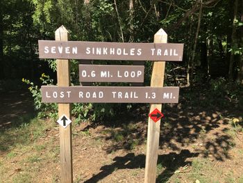
| 0.01 | Junction with Lost Road Trail which is return for Seven Sinkholes Trail | 1180 |
| 0.60 | Back at parking lot | 1120 |
Typical Conditions
Well worn walk across among the limestone outcroppings. Not suitable for stroller use (so put on the baby carrier). Intersection with Lost Road Trail can be confusing.

