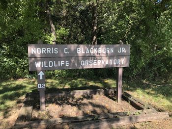
Norris Blackburn Trail: Difference between revisions
(Creating trail page using form) |
(Added missing code for trail map) |
||
| Line 11: | Line 11: | ||
|Trailhead location=36.21181, -83.40654 | |Trailhead location=36.21181, -83.40654 | ||
}} | }} | ||
{{Trail Map}} | |||
__TOC__ | __TOC__ | ||
| Line 34: | Line 36: | ||
==Typical Conditions== | ==Typical Conditions== | ||
Best forest trail tread observed in the park with switchbacks to manage water flow. Would be beautiful with Fall colors. | Best forest trail tread observed in the park with switchbacks to manage water flow. Would be beautiful with Fall colors. No sign of any trimming back the growth along the path. | ||
==Miscellaneous Information== | ==Miscellaneous Information== | ||
In September 2020, the | In September 2020, the wooden steps up to the viewing shelter were removed with caution tape closing the opening. Would be good to get a list of potential wildlife that could be seen here besides deer. | ||
==Gallery== | ==Gallery== | ||
Revision as of 18:52, 9 September 2020
| Norris Blackburn Trail (log in to submit report) | |
|---|---|

| |
| Highlight | Thru maple forest to a wildlife observatory |
| Park | Panther Creek State Park |
| Located | Morristown, TennesseeLocation inherited from associated park |
| Trail Marking | Black arrow on silver diamond |
| Trail UseThings allowed to do on or near the trail | |
| FeaturesThings to see on or near the trail |
|
| Difficulty Rating | Easy |
| Hiking TimeTime from car and back. Includes any time hiking to access this trail. | 30 min0.5 Hours <br />0.0313 Days <br /> round trip |
| Distance: | 0.45 mi0.724 km <br /> trailStrict non-repeating trail length / 0.90.9 mi <br />1.448 km <br /> round tripTypical or shortest length from the car, hike the trail, and return to car |
| Trail Type | In-and-Out |
| High Point | {{{High Point}}}"{{{High Point}}}" is not a number. |
| Elev. Gain/LossSee link for details of calculation. Gain/Loss is direction dependent. | {{{Elevation Gain}}}"{{{Elevation Gain}}}" is not a number. / ({{{Elevation Loss}}}"{{{Elevation Loss}}}" is not a number.) – {{{Elevation Change Direction}}} |
| Trip ReportsFrom user "hiked it" submissions<br />Recent is within last 90 days | 1 logged hikes (0 recent) |
| NearbyWithin 5 mi<br />Click link to view list | 8 trails / 12.2 mi of trail |
| Parking | Map |
| Trailhead | 36° 12' 42.52" N, 83° 24' 23.54" W Map |
|
| |
| Show In Google Maps | |
Download KML / Upload new version / KML File Page / Create Profile Chart / gpsvisualizer Map
Trail Overview
Short walk through forest to wildlife viewing shelter.
How To Get There
Once at the state park, parking in corner between pool and tennis court. Alternatively, a short connector from Old Wagon Trail.
Route Description
Short walk up through mature maple forest. Part of the disc course also threads along the path. Ends at wooden viewing shelter looking out over an open field. Best for birds and other wildlife in early morning.
| Mileage | Feature | Elevation |
|---|---|---|
| 0.00 | Trailhead | |
| 0.xx | Connecting segment to Old Wagon Trail | |
| 0.45 | Wildlife viewing shelter |
Typical Conditions
Best forest trail tread observed in the park with switchbacks to manage water flow. Would be beautiful with Fall colors. No sign of any trimming back the growth along the path.
Miscellaneous Information
In September 2020, the wooden steps up to the viewing shelter were removed with caution tape closing the opening. Would be good to get a list of potential wildlife that could be seen here besides deer.
Gallery


