Tom Gray: Difference between revisions
m (add needs) |
(convert to new trail form template) |
||
| Line 1: | Line 1: | ||
{{Trail | |||
|Banner Image= | |||
|Park=Roan Mountain State Park | |||
|Trail Marking=White | |||
|Trail Use=Hiking | |||
|Trail Features=Vistas, Mountains | |||
|Difficulty Rating=Easy | |||
|Hike Time=1.5 hrs | |||
|Trail Distance=2.193 mi | |||
|Round Trip Distance=4.4 mi | |||
|Trail Type=In-and-Out | |||
|High Point=3,773 ft | |||
|Low Point=2,841 ft | |||
|Elevation Gain=319 ft | |||
|Elevation Loss=1,162 ft | |||
|Elevation Change Direction=West-to-East | |||
|Parking location=36.159208,-82.099615 | |||
|Trailhead location=36.158776,-82.100051 | |||
}} | |||
{{Trail Map}} | |||
__TOC__ | |||
== Trail Overview == | == Trail Overview == | ||
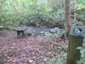
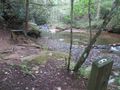
A short trail at [[Roan Mountain State Park]]. Hike along the Doe River with two benches overlooking the river including great swimming spots. The trail is apparently a self-guided hike as there are several numbered stations throughout but no handouts were available at the trail head. The trail head sign is also mis-marked at 1.7 miles, possibly an outdated sign before some trail rearrangements. | A short trail at [[Roan Mountain State Park]]. Hike along the Doe River with two benches overlooking the river including great swimming spots. The trail is apparently a self-guided hike as there are several numbered stations throughout but no handouts were available at the trail head. The trail head sign is also mis-marked at 1.7 miles, possibly an outdated sign before some trail rearrangements. | ||
| Line 49: | Line 30: | ||
== Route Description== | == Route Description== | ||
[[File:Tom gray profile.png|thumb|right]]A short hike along the Doe River beginning from the campground registration. | |||
A short hike along the Doe River beginning from the campground registration. | |||
== Typical Conditions == | == Typical Conditions == | ||
<!-- Typical conditions throughout the year of what to expect on the trail. Rocky, muddy, sandy, flowers, lots of downed trees? --> | <!-- Typical conditions throughout the year of what to expect on the trail. Rocky, muddy, sandy, flowers, lots of downed trees? --> | ||
Being a TN state park, the dirt and gravel trails are kept in good condition. Some of the trail sections are steep, thus can be slippery after a rain. | Being a TN state park, the dirt and gravel trails are kept in good condition. Some of the trail sections are steep, thus can be slippery after a rain. | ||
== Photos == | == Photos == | ||
{{Park trail gallery|Trail={{PAGENAME}}}} | |||
Revision as of 23:16, 3 January 2020
| Tom Gray (log in to submit report) | |
|---|---|
| Park | Roan Mountain State Park |
| Located | Roan Mountain, TennesseeLocation inherited from associated park |
| Trail Marking | White |
| Trail UseThings allowed to do on or near the trail |
|
| FeaturesThings to see on or near the trail |
|
| Difficulty Rating | Easy |
| Hiking TimeTime from car and back. Includes any time hiking to access this trail. | 1.5 hrs0.0938 Days <br />90 Min <br /> round trip |
| Distance: | 2.193 mi3.529 km <br /> trailStrict non-repeating trail length / 4.4 mi7.081 km <br /> round tripTypical or shortest length from the car, hike the trail, and return to car |
| Trail Type | In-and-Out |
| Low / High Point | 2,841 ft947 Yards <br />865.937 Meters <br /> / 3,773 ft1,257.667 Yards <br />1,150.01 Meters <br /> |
| Elev. Gain/LossSee link for details of calculation. Gain/Loss is direction dependent. | 319 ft97.231 Meters <br /> / (1,162 ft354.178 Meters <br />) – West-to-East |
| Trip ReportsFrom user "hiked it" submissions<br />Recent is within last 90 days | No hikes logged yet |
| NearbyWithin 5 mi<br />Click link to view list | 13 trails / 50.7 mi of trail |
| Parking | 36° 9' 33.15" N, 82° 5' 58.61" W Map |
| Trailhead | 36° 9' 31.59" N, 82° 6' 0.18" W Map |
|
| |
| Show In Google Maps | |
Download KML / Upload new version / KML File Page / Create Profile Chart / gpsvisualizer Map
Trail Overview
A short trail at Roan Mountain State Park. Hike along the Doe River with two benches overlooking the river including great swimming spots. The trail is apparently a self-guided hike as there are several numbered stations throughout but no handouts were available at the trail head. The trail head sign is also mis-marked at 1.7 miles, possibly an outdated sign before some trail rearrangements.
How to get there
From the Visitor Center head south on 143 and turn right into the campground area. If not camping, park at the shelter. The trail begins to the left of the new playground and the rear of the clearing.
Route Description

A short hike along the Doe River beginning from the campground registration.
Typical Conditions
Being a TN state park, the dirt and gravel trails are kept in good condition. Some of the trail sections are steep, thus can be slippery after a rain.
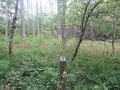
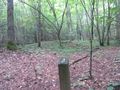
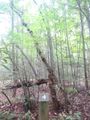
Photos
-
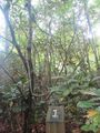
Sign post #1
-
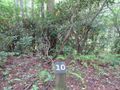
Sign post #10
-
Sign post #11
-

Sign post #2
-
Sign post #3
-
Sign post #4
-
Sign post #5
-

Sign post #6
-

Sign post #7
-
Sign post #8
-

Sign post #9
-

View along trail
-
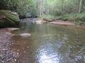
Swimming area
-

Trail Profile


