Guest River Gorge: Difference between revisions
(Corrected infobox coords to parking, infobox map to current standard, added trail gmap) |
(→Maps: Added KML and note) |
||
| Line 56: | Line 56: | ||
<!-- You can place pictures, PDF's, links, or even create a Google map with your waypoints and place it here. --> | <!-- You can place pictures, PDF's, links, or even create a Google map with your waypoints and place it here. --> | ||
<googlemap lat="36.903" lon="-82.4250" type="terrain" zoom="13" scale="yes" icons="http://tehcc.org/clubwiki/kml/marker{label}.png"> | <googlemap lat="36.903" lon="-82.4250" type="terrain" zoom="13" scale="yes" icons="http://tehcc.org/clubwiki/kml/marker{label}.png"> | ||
http://tehcc.org/clubwiki/kml/ | http://tehcc.org/clubwiki/kml/Guest_River_Gorge.kml | ||
(G) 36.89508,-82.41492 | (G) 36.89508,-82.41492 | ||
Lick Log Branch waterfall | |||
(G) 36.8766, -82.40748 | (G) 36.8766, -82.40748 | ||
End of trail at trestle | End of trail at trestle | ||
| Line 65: | Line 65: | ||
Parking lot | Parking lot | ||
</googlemap> | </googlemap> | ||
Note: The Guest River Gorge trail is shown in the Google maps database. The above red trail was measured with a hand held GPS receiver, thus is another approximate measurement. Used to illustrate that the rails-to-trail follows the Guest River closely. | |||
== Photos == | == Photos == | ||
Revision as of 18:04, 1 January 2012
| |||||||||||||||||||||||||||||||||||||
Trail Overview
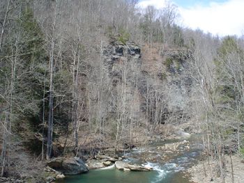
Old railroad grade with wide trail of gentle downhill grade in gorge of rushing Guest River to its mouth at the Clinch River
How to get there
From Gate City, VA
- Proceed north on Va. 72 and through Ft. Blackmore and Dungannon, Va. for 30.2 miles.
- Look for USFS sign to Guest River Trail about 3 miles south of Coeburn, Va. (in case you miss the turn) and turn right.
- Proceed 1.4 miles to parking lot at the trailhead.
Route Description
Walk down steps or take handicapped trail down to old railroad grade. Go right on railroad grade. Go through tunnel and across bridge and follow old railroad grade 6 miles along rushing river and beside sandstone cliffs with a few coal beds to Clinch River and active railroad. There is a rudimentary trail upstream along the Clinch River if you need more.
Typical Conditions
Wide gravel roadbed
Fees, Permits, etc.
After the Hike
Misc. Information
Maps
<googlemap lat="36.903" lon="-82.4250" type="terrain" zoom="13" scale="yes" icons="http://tehcc.org/clubwiki/kml/marker{label}.png"> http://tehcc.org/clubwiki/kml/Guest_River_Gorge.kml
(G) 36.89508,-82.41492 Lick Log Branch waterfall (G) 36.8766, -82.40748 End of trail at trestle (A) 36.92363,-82.45137 Parking lot </googlemap>
Note: The Guest River Gorge trail is shown in the Google maps database. The above red trail was measured with a hand held GPS receiver, thus is another approximate measurement. Used to illustrate that the rails-to-trail follows the Guest River closely.
