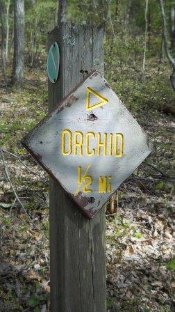
Orchid Trail: Difference between revisions
(Add IB pix and trail sign pix) |
(→Maps: Add elevation profile) |
||
| Line 64: | Line 64: | ||
== Maps == | == Maps == | ||
<!-- You can place pictures, PDF's, links, or even create a Google map with your waypoints and place it here. --> | <!-- You can place pictures, PDF's, links, or even create a Google map with your waypoints and place it here. --> | ||
<googlemap version="0.9" lat="36.50349" lon="-82.61893" type="terrain" zoom="15" width=" | <googlemap version="0.9" lat="36.50349" lon="-82.61893" type="terrain" zoom="15" width="725" scale="yes" icons="http://tehcc.org/clubwiki/kml/marker{label}.png"> | ||
http://tehcc.org/clubwiki/kml/BMP_Orchid_Trail.kml | http://tehcc.org/clubwiki/kml/BMP_Orchid_Trail.kml | ||
http://tehcc.org/clubwiki/kml/BMP_lake_road-partial.kml | http://tehcc.org/clubwiki/kml/BMP_lake_road-partial.kml | ||
| Line 75: | Line 75: | ||
Trailhead at [[BMP Bays Ridge Road|Bays Ridge Road]] | Trailhead at [[BMP Bays Ridge Road|Bays Ridge Road]] | ||
</googlemap> | </googlemap> | ||
:::The following elevation profile proceeds from Lake Road to Bays Ridge Road. | |||
[[Image:BMP Orchid Trail profile.JPG]] | |||
== Photos == | == Photos == | ||
Revision as of 09:20, 26 April 2011
| |||||||||||||||||||||||||||||||||||||
Trail Overview
Located in Bays Mountain Park. Trail between Lake Road and Bays Ridge Road down a hollow. Not certain if wild orchids can be seen along trail.
How to get there
The trail is not directly accessible from the main parking lot. Cross the dam and take either Follow Lake Road or Bays Ridge Road unti a trail sign is seen.
Route Description
Short 0.4 mile connecting trail with many switchback through a hollow between two park roads.
| Miles | Orchid Trail | Miles |
|---|---|---|
| 0.0 | Trailhead at Lake Road | 0.4 |
| 0.4 | Trailhead at Bays Ridge Road | 0.0 |
Typical Conditions
Lesser used trail, thus dirt path well covered with fallen leaves. A few stone steps have been built long time ago.
Regulations
NO BIKES!
Misc. Information
Maps
<googlemap version="0.9" lat="36.50349" lon="-82.61893" type="terrain" zoom="15" width="725" scale="yes" icons="http://tehcc.org/clubwiki/kml/marker{label}.png"> http://tehcc.org/clubwiki/kml/BMP_Orchid_Trail.kml http://tehcc.org/clubwiki/kml/BMP_lake_road-partial.kml http://tehcc.org/clubwiki/kml/BMP_Bays_Ridge_Road.kml
(G) 36.50349,-82.61893
Trailhead at Lake Road

- The following elevation profile proceeds from Lake Road to Bays Ridge Road.
File:BMP Orchid Trail profile.JPG
Photos
- Placeholder.gif
