User talk:Tim: Difference between revisions
(printing question) |
m (answers) |
||
| Line 12: | Line 12: | ||
[[Image:WPSP_Darrel's_Dream_playground.jpg|150px]] | [[Image:WPSP_Darrel's_Dream_playground.jpg|150px]] | ||
does not appear correctly, thus needs permissions fixed.--[[User:Vhasler|Vhasler]] 05:27, 7 April 2011 (EDT) | does not appear correctly, thus needs permissions fixed.--[[User:Vhasler|Vhasler]] 05:27, 7 April 2011 (EDT) | ||
:Fixed! --[[User:Tim|Tim]] 21:34, 7 April 2011 (EDT) | |||
---- | ---- | ||
| Line 25: | Line 26: | ||
:It would be easiest if you email me the actual pin pictures to make sure I get the ones you are referring to. --[[User:Tim|Tim]] 09:57, 7 April 2011 (EDT) | :It would be easiest if you email me the actual pin pictures to make sure I get the ones you are referring to. --[[User:Tim|Tim]] 09:57, 7 April 2011 (EDT) | ||
::I might just download the files and send them to you - or should I upload them to the KML directory - then have you do the background magic? I could up the wiki page to describe what each are used (ie, bridge for bridge and water for no bridge).--[[User:Vhasler|Vhasler]] 14:22, 7 April 2011 (EDT) | ::I might just download the files and send them to you - or should I upload them to the KML directory - then have you do the background magic? I could up the wiki page to describe what each are used (ie, bridge for bridge and water for no bridge).--[[User:Vhasler|Vhasler]] 14:22, 7 April 2011 (EDT) | ||
:::Done! --[[User:Tim|Tim]] 21:34, 7 April 2011 (EDT) | |||
---- | ---- | ||
Is there a way to have a routine that allows selected sections on a wiki page to be printed? Geocaching has a short form - and then an option to only have the last five logs (which is the default appearing when viewing). I just printed out Lakeside Trail to see what needs to be updated as I capture the GPX/KML track for the G-map.--[[User:Vhasler|Vhasler]] 14:22, 7 April 2011 (EDT) | Is there a way to have a routine that allows selected sections on a wiki page to be printed? Geocaching has a short form - and then an option to only have the last five logs (which is the default appearing when viewing). I just printed out Lakeside Trail to see what needs to be updated as I capture the GPX/KML track for the G-map.--[[User:Vhasler|Vhasler]] 14:22, 7 April 2011 (EDT) | ||
:I think you need to show me, not clearly understanding. --[[User:Tim|Tim]] 21:34, 7 April 2011 (EDT) | |||
Revision as of 21:34, 7 April 2011
Help needed list:
Also why do we have three Virginia Creeper listings? I recommend just one trail listing, then on the trail page the different access points can be noted. Might get to that one as boys were considering riding it down again, thus would generate a GPX file.--Vhasler 20:29, 2 April 2011 (EDT)
- Carryover from the way it was listed on the website as I exported and transferred it mostly as is. It had a marker at each major location (Abingdon, Damascus, Whitetop I believe). Totally agree with you, have at it! --Tim 21:00, 2 April 2011 (EDT)
Is there a way to display an externally linked map? Take the Rocky Fork map you just linked. Could it be displayed on the page to show the information versus the G-map (or until GPX/KML are obtained for the trails)? My same question was going to be for the WPSP Mountain Bike Trail System which has a good topo map.--Vhasler 05:27, 7 April 2011 (EDT)
- We could display a picture of it, but you can't, (even "normal" webpages) have embedded PDFs. --Tim 09:57, 7 April 2011 (EDT)
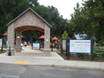
Image for Darrell's Dream boundless playground
 does not appear correctly, thus needs permissions fixed.--Vhasler 05:27, 7 April 2011 (EDT)
- Fixed! --Tim 21:34, 7 April 2011 (EDT)
Icon pins requested from the google-maps-icons website you have linked:
Cemetery
Bridge (old) – for trail bridges to distinguish from rock hopping crossings
Toilets
Bench – ie, Girl Power bench on WPSP Connector Trail
Tunnel – will have two on Doe River Gorge Trail
Playground – for Darrel’s Dream at WPSP
The bridge icon need was the driver for my searching as desire to show the difference as both bridge and no bridge crossings exist on Fall Creek Loop.--Vhasler 08:47, 7 April 2011 (EDT)
- It would be easiest if you email me the actual pin pictures to make sure I get the ones you are referring to. --Tim 09:57, 7 April 2011 (EDT)
- I might just download the files and send them to you - or should I upload them to the KML directory - then have you do the background magic? I could up the wiki page to describe what each are used (ie, bridge for bridge and water for no bridge).--Vhasler 14:22, 7 April 2011 (EDT)
- Done! --Tim 21:34, 7 April 2011 (EDT)
- I might just download the files and send them to you - or should I upload them to the KML directory - then have you do the background magic? I could up the wiki page to describe what each are used (ie, bridge for bridge and water for no bridge).--Vhasler 14:22, 7 April 2011 (EDT)
Is there a way to have a routine that allows selected sections on a wiki page to be printed? Geocaching has a short form - and then an option to only have the last five logs (which is the default appearing when viewing). I just printed out Lakeside Trail to see what needs to be updated as I capture the GPX/KML track for the G-map.--Vhasler 14:22, 7 April 2011 (EDT)
- I think you need to show me, not clearly understanding. --Tim 21:34, 7 April 2011 (EDT)