Guest River Gorge: Difference between revisions
(eqvdUynL) |
m (Text replacement - "http://tehcc.org/clubwiki/" to "https://tehcc.org/clubwiki/") |
||
| (10 intermediate revisions by 5 users not shown) | |||
| Line 1: | Line 1: | ||
<!-- The following few lines create the "Infobox" table template. Please scroll down to edit the main content of the article. | |||
-->{{Infobox Trail | |||
| Image Name = GuestRiverGorge-20040320-1.jpg | |||
| City = Coeburn | |||
| State = Virginia | |||
| Marking = None | |||
| Trail Use = {{Hike}} {{Biking}} {{Dogs}} | |||
| Difficulty Rating = Easy | |||
| Hike Time = 5.5 | |||
| Distance = 11.6 | |||
| Elevation Gain = 650 | |||
| High Point = 2,035 | |||
| Latitude = 36.92363 | |||
| Longitude = -82.45137 | |||
| Medical = Coeburn, VA | |||
}}<!-- | |||
End Infobox template table | |||
-->{{Trail page needs | |||
| Hide needs = | |||
| KML = | |||
| Updated KML = | |||
| Detail route description = Yes | |||
| Photos = Yes | |||
| Winter photos = | |||
| Remove prefix = | |||
| Update infobox = Yes | |||
| Infobox data update = Yes | |||
| Trail pins = Yes | |||
| Other = | |||
| Comment = | |||
| Date reviewed = 10/25/2015 | |||
}}<!-- | |||
Start of Main Page --> | |||
== Trail Overview == | |||
<!-- Enter a overview of the trail. What attracts you to this trail, points of interest, types of flowers, lakes, and peaks that you see along the way. --> | |||
Rails-to-trail with a gentle grade of wide fine gravel in the rushing Guest River gorge to its mouth at the Clinch River. Passes through an old tunnel and crosses a couple of wood trestles. | |||
== How to get there == | |||
<!-- Please enter detailed instruction on how to find the trail head. --> | |||
From Gate City, VA | |||
#Proceed north on VA-72 and through Ft. Blackmore and Dungannon for 30 miles. | |||
#Look for USFS sign to Guest River Trail on right about 3 miles south of Coeburn. | |||
#Proceed 1.4 miles to parking lot at the trailhead. | |||
== Route Description== | |||
<!-- Detailed description of the route. Is there any side trails that are worth traveling? --> | |||
Walk down steps or take handicapped trail down to old railroad grade. Pass through the former railroad tunnel, built in 1922, and then cross the wood trestle bridge. The trail follows old railroad grade for 5.8 miles downhill, per the mile markers, along rushing river and beside sandstone cliffs with a few coal beds to Clinch River and active railroad. Backtrack uphill to parking area. Do not recommend the obviously unmaintained bike trail which continues upstream along the Clinch River. | |||
The wide rails-to-trail path is easily shared with mountain bikes. There are a couple of small waterfalls on the uphill side, which pass under the trail through culverts. | |||
Folks fishing the Guest River may be seen - especially on the concrete erosion pier between 4-5 miles. Valid state fishing license is required. | |||
== Typical Conditions == | |||
<!-- Typical conditions throughout the year of what to expect on the trail. Rocky, muddy, sandy, flowers, lots of downed trees? --> | |||
Wide fine gravel roadbed. The Forest Service actively maintains the trail by removing blowdowns and cutting back the annual growth. Some fresh beaver activity was observed by the tree fallen across the path at the 5 mile marker. There is pit toilets at the trailhead, but no water source. Pack out any bottles and food wrappers. | |||
==Fees, Permits, etc. == | |||
<!-- Please list any Fees, Permits, Regulations, etc. that may be required on this trail.--> | |||
No fees. The trail and parking area are closed at night. | |||
See also [http://www.fs.usda.gov/recarea/gwj/recreation/hiking/recarea/?recid=78552&actid=50 Forest Service trail information]. Managed by Clinch Ranger District (Wise, VA) Telephone: 276-679-8370. Office hours are Monday-Friday, 8AM to 4:30PM. | |||
== After the Hike == | |||
<!-- Other things to check out while you're in the area. Restaurants, attractions, monuments, etc... --> | |||
== Misc. Information == | |||
<!-- Enter any additional information that doesn't fit an any other fields. Does this trail require any permits for overnight? parking? --> | |||
== Maps == | |||
<!-- You can place pictures, PDF's, links, or even create a Google map with your waypoints and place it here. --> | |||
<display_map type="terrain" gkml="https://tehcc.org/clubwiki/kml/Guest_River_Gorge.kml"> | |||
36.89508,-82.41492~Lick Log Branch waterfall~ ~MarkerG.png | |||
36.8766, -82.40748~End of trail at trestle~ ~MarkerG.png | |||
36.92363,-82.45137~Parking lot~ ~MarkerA.png | |||
36.91088,-82.4637~Entrance sign to trailhead parking~[[Image:Guest River Gorge - Jefferson National Forest sign.JPG|150px]]~MarkerG.png | |||
</display_map> | |||
Note: The Guest River Gorge trail is shown in the Google maps database. The above red trail was measured with a hand held GPS receiver, thus is another approximate measurement. Used to illustrate that the rails-to-trail follows the Guest River closely. | |||
== Photos == | |||
<gallery> | |||
<!-- Place any pictures from this trail below. Add a picture by typing Image:imagename.extension --> | |||
Image:Guest River Gorge - Jefferson National Forest sign.JPG|Entrance sign to trailhead | |||
<!-- Do not remove the end gallery code.--> | |||
</gallery> | |||
<!-- Finally add the trail to any Categories it should belong to. Please keep the State category. To make a new category just type [[Category:mycategory]]. Keep in mind categories are case sensitive. --> | |||
[[Category:Virginia]] [[Category:Easy]] [[Category:Biking]] [[Category:Dog Friendly]] | |||
Latest revision as of 11:12, 7 January 2023
| |||||||||||||||||||||||||||||||||||||

Trail Overview[edit]
Rails-to-trail with a gentle grade of wide fine gravel in the rushing Guest River gorge to its mouth at the Clinch River. Passes through an old tunnel and crosses a couple of wood trestles.
How to get there[edit]
From Gate City, VA
- Proceed north on VA-72 and through Ft. Blackmore and Dungannon for 30 miles.
- Look for USFS sign to Guest River Trail on right about 3 miles south of Coeburn.
- Proceed 1.4 miles to parking lot at the trailhead.
Route Description[edit]
Walk down steps or take handicapped trail down to old railroad grade. Pass through the former railroad tunnel, built in 1922, and then cross the wood trestle bridge. The trail follows old railroad grade for 5.8 miles downhill, per the mile markers, along rushing river and beside sandstone cliffs with a few coal beds to Clinch River and active railroad. Backtrack uphill to parking area. Do not recommend the obviously unmaintained bike trail which continues upstream along the Clinch River.
The wide rails-to-trail path is easily shared with mountain bikes. There are a couple of small waterfalls on the uphill side, which pass under the trail through culverts.
Folks fishing the Guest River may be seen - especially on the concrete erosion pier between 4-5 miles. Valid state fishing license is required.
Typical Conditions[edit]
Wide fine gravel roadbed. The Forest Service actively maintains the trail by removing blowdowns and cutting back the annual growth. Some fresh beaver activity was observed by the tree fallen across the path at the 5 mile marker. There is pit toilets at the trailhead, but no water source. Pack out any bottles and food wrappers.
Fees, Permits, etc.[edit]
No fees. The trail and parking area are closed at night.
See also Forest Service trail information. Managed by Clinch Ranger District (Wise, VA) Telephone: 276-679-8370. Office hours are Monday-Friday, 8AM to 4:30PM.
After the Hike[edit]
Misc. Information[edit]
Maps[edit]
Note: The Guest River Gorge trail is shown in the Google maps database. The above red trail was measured with a hand held GPS receiver, thus is another approximate measurement. Used to illustrate that the rails-to-trail follows the Guest River closely.
Photos[edit]
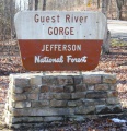
Entrance sign to trailhead
