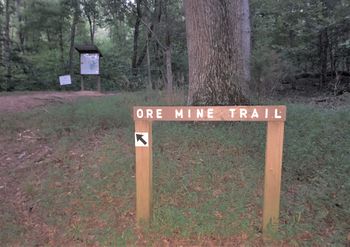
Ore Mine Trail: Difference between revisions
Jump to navigation
Jump to search
No edit summary |
(→Trail Overview: Filled in knowledge gap) |
||
| (2 intermediate revisions by the same user not shown) | |||
| Line 23: | Line 23: | ||
==Trail Overview== | ==Trail Overview== | ||
Loop trail around hill reportedly where | Loop trail around hill reportedly where manganese was mined in early 1800's. Lots of deer in early morning. Lake views when leaves are down. | ||
==How To Get There== | ==How To Get There== | ||
| Line 39: | Line 39: | ||
| 0.15 || Loop intersection || 1220 | | 0.15 || Loop intersection || 1220 | ||
|- | |- | ||
| 0. | | 0.40 || Junction to [[Point Lookout Trail]]|| 1190 | ||
|- | |- | ||
| 1.15 || Unmarked intersection with Lost Road Trail || 1370 | | 0.90 || Bench / Intersection with [[Lost Road Trail]] || 1450 | ||
|- | |||
| 1.15 || Unmarked intersection with [[Lost Road Trail]] || 1370 | |||
|- | |- | ||
| 1.50 || Back at loop intersection || 1220 | | 1.50 || Back at loop intersection || 1220 | ||
| Line 71: | Line 73: | ||
|Marker Title=Ore Mine Trail | |Marker Title=Ore Mine Trail | ||
|Marker Description=Loop sign | |Marker Description=Loop sign | ||
|Marker Location=36. | |Marker Location=36.217994,-83.403958 | ||
}} | }} | ||
{{Map Marker | {{Map Marker | ||
Latest revision as of 07:20, 14 September 2020
| Ore Mine Trail (log in to submit report) | |
|---|---|

| |
| Highlight | Loop around Ore Mine Hill |
| Park | Panther Creek State Park |
| Located | Morristown, TennesseeLocation inherited from associated park |
| Trail Marking | Black arrow on silver diamond |
| Trail UseThings allowed to do on or near the trail | |
| FeaturesThings to see on or near the trail | |
| Difficulty Rating | Medium |
| Hiking TimeTime from car and back. Includes any time hiking to access this trail. | 1 hr0.0625 Days <br />60 Min <br /> round trip |
| Distance: | 1.7 mi2.736 km <br /> trailStrict non-repeating trail length / 1.7 mi2.736 km <br /> round tripTypical or shortest length from the car, hike the trail, and return to car |
| Trail Type | Loop |
| Low / High Point | 1140 ft380 Yards <br />347.472 Meters <br /> / 1450 ft483.333 Yards <br />441.96 Meters <br /> |
| Elev. Gain/LossSee link for details of calculation. Gain/Loss is direction dependent. | 467 ft142.342 Meters <br /> / (467 ft142.342 Meters <br />) – Clockwise |
| Trip ReportsFrom user "hiked it" submissions<br />Recent is within last 90 days | 1 logged hikes (0 recent) |
| NearbyWithin 5 mi<br />Click link to view list | 8 trails / 11.0 mi of trail |
| Parking | 36° 12' 57.60" N, 83° 24' 20.02" W Map |
| Trailhead | 36° 12' 59.29" N, 83° 24' 19.98" W Map |
|
| |
| Show In Google Maps | |
Download KML / Upload new version / KML File Page / Create Profile Chart / gpsvisualizer Map
Trail Overview[edit]
Loop trail around hill reportedly where manganese was mined in early 1800's. Lots of deer in early morning. Lake views when leaves are down.
How To Get There[edit]
Park at the end of Spoone Recreation Area. (Note: Bathroom facility nearby.)
Route Description[edit]
A loop with an in-and-out segment from parking.
| Mileage | Feature | Elevation |
|---|---|---|
| 0.00 | Spoone Rec Area parking lot | 1140 |
| 0.15 | Loop intersection | 1220 |
| 0.40 | Junction to Point Lookout Trail | 1190 |
| 0.90 | Bench / Intersection with Lost Road Trail | 1450 |
| 1.15 | Unmarked intersection with Lost Road Trail | 1370 |
| 1.50 | Back at loop intersection | 1220 |
| 1.70 | Back at parking lot | 1140 |
Typical Conditions[edit]
Varies between rocky and rooty path to steep ascent to very nice forest walk to overgrown path. Could specific trail sign at the intersection with Lost Road Trail.
Miscellaneous Information[edit]
Gallery[edit]


