Blackstack Cliffs (AT): Difference between revisions
(Clarified route description) |
|||
| (One intermediate revision by the same user not shown) | |||
| Line 47: | Line 47: | ||
== Route Description== | == Route Description== | ||
<!-- Detailed description of the route. Is there any side trails that are worth traveling? --> | <!-- Detailed description of the route. Is there any side trails that are worth traveling? --> | ||
Toward the very end of the paved road going through Jones Meadow, you will see an unpaved road forking off to your right marked with blue blazes. This is a spur trail (not suitable for vehicles) that leads to the Appalachian Trail. Park near this blue-blazed spur trail. Following the blue-blazed trail, you will come upon a small clearing with multiple trails going in different directions. Continue straight through the clearing, following the blue blazed trail until you come to the white-blazed AT. Head north-bound (left) on the white-blazed AT for 0.2 miles. In a turn, there is a brown sign stated Blackstack Cliff for an unmarked spur trail up the hill. Continue for ~75 yards to a stone ledge with a US Forest Service benchmark. Take the big steps down and proceed until you emerge at the cliffs. | Toward the very end of the paved road going through Jones Meadow, you will see an unpaved road forking off to your right marked with blue blazes. This is a spur trail (not suitable for vehicles) that leads to the Appalachian Trail. Park near this blue-blazed spur trail. Following the blue-blazed trail for about 0.2 miles, you will come upon a small clearing with multiple trails going in different directions. Continue straight through the clearing, following the blue blazed trail until you come to the white-blazed AT. Head north-bound (left) on the white-blazed AT for 0.2 miles. In a turn, there is a brown sign stated Blackstack Cliff for an unmarked spur trail up the hill. Continue for ~75 yards to a stone ledge with a US Forest Service benchmark. Take the big steps down and proceed until you emerge at the cliffs. | ||
== Typical Conditions == | == Typical Conditions == | ||
<!-- Typical conditions throughout the year of what to expect on the trail. Rocky, muddy, sandy, flowers, lots of downed trees? --> | <!-- Typical conditions throughout the year of what to expect on the trail. Rocky, muddy, sandy, flowers, lots of downed trees? --> | ||
The spur trail | The spur trail is rather rocky and inclined at times, but the rhododendron that once made the spur trail somewhat difficult to navigate have been cleared. | ||
==Fees, Permits, etc. == | ==Fees, Permits, etc. == | ||
Latest revision as of 10:14, 30 July 2018
| |||||||||||||||||||||||||||||||||||||
Trail Overview[edit]
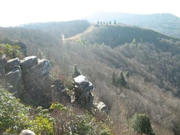
A short spur off Appalachian Trail through rhododendron leads to overlook from these cliffs - great lunch spot.
How to get there[edit]
From Greeneville, TN
- Take TN-107/TN-70 south out of town for 15 miles.
- Turn left onto Viking Mountain Road for 6.5 miles.
- Which becomes gravel Bald Mountain Road for last couple of miles.
- Park in Jones Meadow at turnaround
Route Description[edit]
Toward the very end of the paved road going through Jones Meadow, you will see an unpaved road forking off to your right marked with blue blazes. This is a spur trail (not suitable for vehicles) that leads to the Appalachian Trail. Park near this blue-blazed spur trail. Following the blue-blazed trail for about 0.2 miles, you will come upon a small clearing with multiple trails going in different directions. Continue straight through the clearing, following the blue blazed trail until you come to the white-blazed AT. Head north-bound (left) on the white-blazed AT for 0.2 miles. In a turn, there is a brown sign stated Blackstack Cliff for an unmarked spur trail up the hill. Continue for ~75 yards to a stone ledge with a US Forest Service benchmark. Take the big steps down and proceed until you emerge at the cliffs.
Typical Conditions[edit]
The spur trail is rather rocky and inclined at times, but the rhododendron that once made the spur trail somewhat difficult to navigate have been cleared.
Fees, Permits, etc.[edit]
No fee or permit to visit
After the Hike[edit]
If the nearby firetower on Camp Creek Bald is open, then tremendous views can be observed. Recommended second leg for a hike up here on Viking Mountain.
After hikes in 2009, pizza and pasta were enjoyed at the Brick Oven Italian Restaurant in Greeneville, TN (follow TN107 back to 1001 W Main Street).

