Bays Mountain Road: Difference between revisions
(→Maps: Updating for new Maps extension) |
(General clean up) |
||
| Line 1: | Line 1: | ||
<!-- The following few lines create the "Infobox" table template. Please scroll down to edit the main content of the article. --> | <!-- The following few lines create the "Infobox" table template. Please scroll down to edit the main content of the article. --> | ||
{{Infobox Trail | {{Infobox Trail | ||
| Image Name = BMP Bays Mountain Road gate.JPG | |||
| Park = Bays Mountain Park | |||
| City = Kingsport | |||
| State = Tennessee | |||
| Marking = Junction Signs | |||
| Trail Use = {{Hike}} {{Biking}} {{Dogs}} | |||
| Difficulty Rating = Moderate | |||
| Hike Time = 2 Hours | |||
| Distance = 2.1 | |||
| Elevation Gain = 393 | |||
| High Point = 2237 | |||
| Latitude = 36.508537 | |||
| Longitude = -82.611171 | |||
| Medical = Kingsport, TN | |||
}} | }} | ||
<!-- End Infobox template table--> | <!-- End Infobox template table--> | ||
| Line 89: | Line 90: | ||
<!-- Place any pictures from this trail below. Ideally we would have a picture of the trailhead to help people know when they found it --> | <!-- Place any pictures from this trail below. Ideally we would have a picture of the trailhead to help people know when they found it --> | ||
<!-- Add a picture by typing Image:imagename.extension --> | <!-- Add a picture by typing Image:imagename.extension --> | ||
Image: | Image:BMP Antennas2.JPG | ||
Image:BMP Bays Mountain Road gate.JPG | |||
<!-- Do not remove the end gallery code.--> | <!-- Do not remove the end gallery code.--> | ||
</gallery> | </gallery> | ||
Revision as of 22:46, 7 September 2015
| |||||||||||||||||||||||||||||||||||||||
Trail Overview
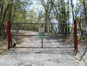
Located in Bays Mountain Park. This is an vehicle restricted antenna service access road that sees very little traffic. It offers both a lookout tower and overlook area looking southward into Kingsport and the surrounding area. It's wide trail can make it a comfortable social hike for larger groups. This trail also allows bikes once inspected and stickered by park staff.
How to get there
From the main parking lot, go towards the telescope observatory and walk up the road towards the access gate. Follow the trail on the right that will eventually merge with the road on the ridge.
Route Description
The path starts off fairly steep but levels off once on the ridge. This trail meets up with River Mountain Road and Azalea Trail for possible loops hikes
| Miles | Bays Mountain Road | Miles |
|---|---|---|
| 0.0 | Lake Road Gate | 2.1 |
| 0.4 | Observation Tower/Cliffside Trail junction | 1.7 |
| 1.7 | Overlook | 0.4 |
| 2.0 | Azalea Trail junction | 0.1 |
| 2.1 | antenna point/River Mountain Road junction | 0.0 |
Typical Conditions
The trail is fairly wide to allow service trucks and can be rutted and with puddles in wetter months.
Fees, Permits, etc.
See the Bays Mountain Park page for details
After the Hike
Visit the other trails, animal exhibits, and Nature Center

