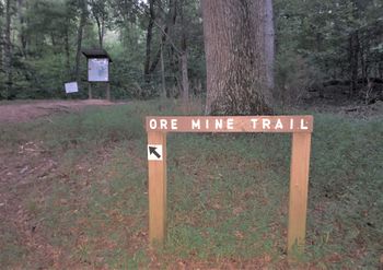
Ore Mine Trail: Difference between revisions
Jump to navigation
Jump to search
No edit summary |
(More edits) |
||
| Line 38: | Line 38: | ||
|- | |- | ||
| 0.15 || Loop intersection || 1220 | | 0.15 || Loop intersection || 1220 | ||
|- | |||
| 0.40 || Junction to [[Lookout Point Trail]]|| 1190 | |||
|- | |- | ||
| 0.90 || Bench / Intersection with Lost Road Trail || 1450 | | 0.90 || Bench / Intersection with Lost Road Trail || 1450 | ||
| Line 71: | Line 73: | ||
|Marker Title=Ore Mine Trail | |Marker Title=Ore Mine Trail | ||
|Marker Description=Loop sign | |Marker Description=Loop sign | ||
|Marker Location=36. | |Marker Location=36.217994,-83.403958 | ||
}} | }} | ||
{{Map Marker | {{Map Marker | ||
Revision as of 05:48, 14 September 2020
| Ore Mine Trail (log in to submit report) | |
|---|---|

| |
| Highlight | Loop around Ore Mine Hill |
| Park | Panther Creek State Park |
| Located | Morristown, TennesseeLocation inherited from associated park |
| Trail Marking | Black arrow on silver diamond |
| Trail UseThings allowed to do on or near the trail | |
| FeaturesThings to see on or near the trail | |
| Difficulty Rating | Medium |
| Hiking TimeTime from car and back. Includes any time hiking to access this trail. | 1 hr0.0625 Days <br />60 Min <br /> round trip |
| Distance: | 1.7 mi2.736 km <br /> trailStrict non-repeating trail length / 1.7 mi2.736 km <br /> round tripTypical or shortest length from the car, hike the trail, and return to car |
| Trail Type | Loop |
| Low / High Point | 1140 ft380 Yards <br />347.472 Meters <br /> / 1450 ft483.333 Yards <br />441.96 Meters <br /> |
| Elev. Gain/LossSee link for details of calculation. Gain/Loss is direction dependent. | 467 ft142.342 Meters <br /> / (467 ft142.342 Meters <br />) – Clockwise |
| Trip ReportsFrom user "hiked it" submissions<br />Recent is within last 90 days | 1 logged hikes (0 recent) |
| NearbyWithin 5 mi<br />Click link to view list | 8 trails / 11.0 mi of trail |
| Parking | 36° 12' 57.60" N, 83° 24' 20.02" W Map |
| Trailhead | 36° 12' 59.29" N, 83° 24' 19.98" W Map |
|
| |
| Show In Google Maps | |
Download KML / Upload new version / KML File Page / Create Profile Chart / gpsvisualizer Map
Trail Overview
Loop trail around hill reportedly where XXX was mined. Lots of deer in early morning. Lake views when leaves are down.
How To Get There
Park at the end of Spoone Recreation Area. (Note: Bathroom facility nearby.)
Route Description
A loop with an in-and-out segment from parking.
| Mileage | Feature | Elevation |
|---|---|---|
| 0.00 | Spoone Rec Area parking lot | 1140 |
| 0.15 | Loop intersection | 1220 |
| 0.40 | Junction to Lookout Point Trail | 1190 |
| 0.90 | Bench / Intersection with Lost Road Trail | 1450 |
| 1.15 | Unmarked intersection with Lost Road Trail | 1370 |
| 1.50 | Back at loop intersection | 1220 |
| 1.70 | Back at parking lot | 1140 |
Typical Conditions
Varies between rocky and rooty path to steep ascent to very nice forest walk to overgrown path. Could specific trail sign at the intersection with Lost Road Trail.
Miscellaneous Information
Gallery


