Fawn Loop
| Fawn Loop (log in to submit report) | |
|---|---|

| |
| Trail System | Warriors' Path State Park Mountain Bike Trails |
| Park | Warriors' Path State Park |
| Located | Kingsport, TennesseeLocation inherited from associated park |
| Trail Marking | Yellow |
| Trail UseThings allowed to do on or near the trail |
|
| FeaturesThings to see on or near the trail |
|
| Difficulty Rating | Easy |
| Hiking TimeTime from car and back. Includes any time hiking to access this trail. | 15 min0.25 Hours <br />0.0156 Days <br /> round trip |
| Distance: | 0.61 mi0.982 km <br /> trailStrict non-repeating trail length / 0.75 mi1.207 km <br /> round tripTypical or shortest length from the car, hike the trail, and return to car |
| Trail Type | Loop |
| Low / High Point | 1,414 ft471.333 Yards <br />430.987 Meters <br /> / 1,479 Ft493 Yards <br />450.799 Meters <br /> |
| Elev. Gain/LossSee link for details of calculation. Gain/Loss is direction dependent. | 34 Ft10.363 Meters <br /> / (34 Ft10.363 Meters <br />) – Clockwise |
| Trip ReportsFrom user "hiked it" submissions<br />Recent is within last 90 days | No hikes logged yet |
| NearbyWithin 5 mi<br />Click link to view list | 24 trails / 19.0 mi of trail |
| Parking | 36° 29' 31.67" N, 82° 28' 6.85" W Map |
| Trailhead | 36° 29' 29.44" N, 82° 28' 9.12" W Map |
|
| |
| Show In Google Maps | |
Download KML / Upload new version / KML File Page / Create Profile Chart / gpsvisualizer Map
Trail Overview[edit]
Located in Warriors Path State Park.
How to get there[edit]
From main entrance of Warriors Path State Park:
- Go north on Fall Creek Road for 2.4 miles.
- Turn right (east) onto Old Mill Road for 0.8 miles.
- Turn right (south) onto Childress Ferry Road for just roughly 100 yards.
- Turn left (east) onto Buttermilk Road for 1.2 miles.
- Turn right (south) onto Freeman Road for 0.5 mile.
- Continue when road changes from asphalt to gravel.
Trailhead at gravel parking lot.
Route Description[edit]

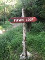
Hike from the parking lot kiosk across the power line path cut and follow the sign to hike Fawn loop. Several major trail intersections occur, but are usually clearly marked on how to stay on the path.
This trail has connections to Pawpaw Connector, Boneyard Connector, Lake Road, and Whitetail Alternate.
Typical Conditions[edit]
The mountain biking association SORBA Tri-Cities handles the trail maintenance, thus generally in good condition. While there are no blazes to guide you through the forest, the narrow single tracks are well established. Grab a trail map at the parking lot kiosk to help you decipher intersections; some which could use signs. Be aware for approaching bike riders who can come up quickly on your group. Step aside to let them safely pass.
Fees, Permits, etc.[edit]
No fee required. Dogs are allowed on or off leash. Do not drink any water without treatment!
Photos[edit]

Trail Profile
Trail crossing sign