|
|
|
|
|
| Trail Name
|
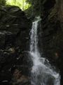
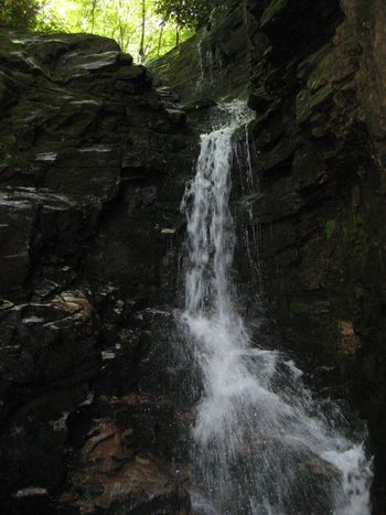
Rock Creek Falls
|
| Nearest City
|
Erwin
|
| State
|
Tennessee
|
| Trail Marking
|
{{{Marking}}}
|
| Trail Use/Features
|
  
|
| Difficulty Rating
|
Easy
|
| Hiking Time
|
33 Hours <br />0.188 Days <br />180 Min <br />
|
| Distance, round-trip
|
55 mi <br />8.047 km <br />
|
| Climb/Descent Elevation
|
800800 Feet <br />243.84 Meters <br /> / {{{Elevation Loss}}}"{{{Elevation Loss}}}" is not a number.
|
| High Point
|
32633,263 Feet <br />1,087.667 Yards <br />994.562 Meters <br />
|
| Nearest Medical
|
Erwin, TN
|
| Trip Reports
|
Click Here
|
|
|
Loading map... {"type":"ROADMAP","minzoom":false,"maxzoom":false,"types":["ROADMAP","SATELLITE","HYBRID","TERRAIN"],"mappingservice":"googlemaps3","width":"270px","height":"180px","centre":false,"title":"","label":"","icon":"","lines":[],"polygons":[],"circles":[],"rectangles":[],"copycoords":false,"static":false,"visitedicon":"","wmsoverlay":false,"zoom":8,"layers":[],"controls":["zoom"],"zoomstyle":"DEFAULT","typestyle":"DEFAULT","autoinfowindows":false,"resizable":false,"kmlrezoom":false,"poi":true,"cluster":false,"clustergridsize":60,"clustermaxzoom":20,"clusterzoomonclick":true,"clusteraveragecenter":true,"clusterminsize":2,"imageoverlays":[],"kml":[],"gkml":[],"searchmarkers":"","fullscreen":false,"scrollwheelzoom":false,"locations":[{"text":"","title":"","link":"","lat":36.13898499999999813780959811992943286895751953125,"lon":-82.3466489999999993187884683720767498016357421875,"icon":""}]} |
|
| Show Large Map
|
|
Trail Overview
Located in Cherokee National Forest, hike to the falls with several stream crossings.
How to get there
From Erwin, TN
- Take Exit 36 off I-26.
- Turn left on unnamed road across the interstate to intersection with Tenn. 107 in Erwin.
- Turn right on Tenn. 107 for about a mile.
- Turn left on Tenn. 395 (USFS sign to Beauty Spot).
- Proceed 3.2 miles.
- Turn left into the USFS Rock Creek Recreation Area.
- Park near restrooms at Picnic Area.
Same as for Rattlesnake Ridge Trail
Route Description
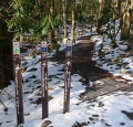
An old road beginning at the end of the pavement in the campground is the trailhead. Forest Service Trail #148 Rock Creek Falls follows the Rock Creek as it winds up the hollow.
Typical Conditions
Fees, Permits, etc.
After the Hike
Misc. Information
Rock Creek Campground is open May 1 through November 1.
Maps
Photos
Trailhead also with Rattlesnake Ridge