Search results
Jump to navigation
Jump to search
Page title matches
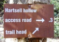
File:White Rock Trail - Hartsell Hollow trail sign.JPG |File name=White Rock Trail - Hartsell Hollow trail sign.JPG |Trail=White Rock Trail(448 × 317 (109 KB)) - 22:52, 23 December 2018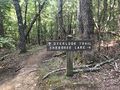
File:PCSP Point Lookout Trail - spur trail sign.JPG |File name=PCSP Point Lookout Trail - spur trail sign.JPG |Trail=Point Lookout Trail(4,032 × 3,024 (7.89 MB)) - 21:04, 11 September 2020
File:PCSP Norris Blackburn Trail - hiking trail marker.JPG |File name=PCSP Norris Blackburn Trail - hiking trail marker.JPG |Trail=Norris Blackburn Trail(3,024 × 4,032 (5.37 MB)) - 21:24, 11 September 2020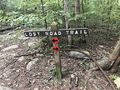
File:PCSP Lost Road Trail - trail junction sign.JPG |File name=PCSP Lost Road Trail - trail junction sign.JPG |Trail=Lost Road Trail(4,032 × 3,024 (5.83 MB)) - 07:50, 14 September 2020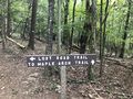
File:PCSP Lost Road Trail - another trail junction sign.JPG |File name=PCSP Lost Road Trail - another trail junction sign.JPG |Trail=Lost Road Trail(4,032 × 3,024 (5.76 MB)) - 08:02, 14 September 2020
File:Phipps Bend Trail - near trail end.jpg |File name=Phipps Bend Trail - near trail end.jpg |Trail=Phipps Bend Trail(600 × 450 (80 KB)) - 12:39, 28 July 2020
File:Trail Markers.JPG |File name=Trail Markers.JPG |Trail=Phipps Bend Trail(3,024 × 4,032 (5.68 MB)) - 08:55, 9 August 2020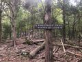
File:Trail intersection.jpg |File name=Trail intersection.jpg |Trail=Ridge Crest Trail(640 × 480 (165 KB)) - 17:24, 6 September 2020
File:Trail Wiki Layout.png (1,006 × 541 (28 KB)) - 00:27, 12 December 2019
File:Towhee trail profile.png |File name=Towhee trail profile.png |Trail=Towhee Trail(1,160 × 660 (23 KB)) - 23:27, 15 December 2019
File:Hemlock trail profile.png |File name=Hemlock trail profile.png |Trail=Hemlock Trail(1,160 × 660 (23 KB)) - 15:40, 15 December 2019
File:Holly trail profile.png |File name=Holly trail profile.png |Trail=Holly Trail(1,160 × 660 (22 KB)) - 17:00, 15 December 2019
File:Pine trail profile.png |File name=Pine trail profile.png |Trail=Pine Trail(1,160 × 660 (22 KB)) - 20:05, 15 December 2019
File:Cliffside trail profile.png |File name=Cliffside trail profile.png |Trail=Cliffside Trail(1,160 × 660 (22 KB)) - 22:40, 14 December 2019
File:Chinquapin Trail Profile.png |File name=Chinquapin Trail Profile.png |Trail=Chinquapin Trail(1,160 × 660 (27 KB)) - 20:46, 14 December 2019
File:Trail edit with form.png Editing a trail page with the form(1,646 × 373 (446 KB)) - 23:11, 12 December 2019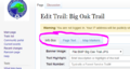
File:Three trail editing tabs.png trail editing tabs(620 × 329 (50 KB)) - 23:20, 12 December 2019
File:Chestnut trail profile.png |File name=Chestnut trail profile.png |Trail=Chestnut Trail(1,160 × 660 (28 KB)) - 14:45, 14 December 2019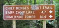
File:CBST Trail Sign.JPG |File name=CBST Trail Sign.JPG |Trail=Chief Benge Scout Trail(448 × 212 (94 KB)) - 00:04, 2 March 2020
File:Cloudland trail profile.png |File name=Cloudland trail profile.png |Trail=Cloudland (Roan Mountain State Park)(1,160 × 660 (24 KB)) - 17:41, 20 December 2019


Page text matches
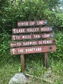
File:WPSP Main Split signs.JPG |Trail=Boneyard, Lake Road (Warriors Path State Park), Whitetail Loop, Zipline |Caption=Signs at main trail split(3,024 × 4,032 (4.76 MB)) - 11:45, 24 June 2023
File:The Great Channels1.jpg |Trail=The Channels Natural Area Preserve(768 × 1,024 (139 KB)) - 22:39, 15 November 2018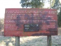
File:Sinking Waters information sign.jpg |Trail=Sinking Waters(768 × 576 (123 KB)) - 15:07, 20 November 2018
File:Comparison of etrex and forerunner logging.PNG ...nta/pink. The eTrex track was more consistent upon trail returns and known trail locations/shape.(1,566 × 974 (3.49 MB)) - 00:39, 2 January 2020
File:Sinking Waters sinkhole.jpg |Trail=Sinking Waters(2,048 × 1,536 (910 KB)) - 12:24, 19 November 2018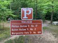
File:IMG 3495.jpg |Trail=Margarette Falls(640 × 480 (161 KB)) - 21:05, 21 May 2023
File:Margarette Falls-profile.png |Trail=Margarette Falls(760 × 460 (22 KB)) - 22:32, 4 December 2018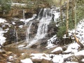
File:Margarette falls 01.jpg |Trail=Margarette Falls(1,200 × 900 (620 KB)) - 22:08, 4 December 2018
File:Dnr atv.png Trail logo to signify ATV use |Caption=Signifies that ATVs are allowed on at least some of the trail<br>'''Note''': Check with proper authorities for which specific trails allo(80 × 80 (2 KB)) - 18:29, 21 November 2018
File:Dnr bike.png |Caption=Signifies that bicycles are allowed on at least some of the trail<br>'''Note''': Check with proper authorities for which specific trails allo(80 × 80 (2 KB)) - 18:30, 21 November 2018
File:Dnr fishing.png ...ignifies that fishing might be allowed on at least some streams nearby the trail<br>'''Note:''' Check with proper authorities for locations and license requ(80 × 80 (1 KB)) - 18:21, 21 November 2018
File:Dnr hiking.png |Caption=Signifies that hiking is allowed on the trail(80 × 80 (2 KB)) - 17:44, 21 November 2018
File:Dnr skiing.png |Caption=Signifies that skiing is allowed on the trail and is common in the winter(80 × 80 (1 KB)) - 18:26, 21 November 2018
File:Dnr waterfall.png |Caption=There are waterfalls within the park or near the trail(80 × 80 (2 KB)) - 09:17, 23 November 2018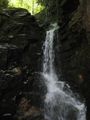
File:Rock Creek Falls.jpg |Trail=Rock Creek Falls(900 × 1,200 (420 KB)) - 11:06, 19 September 2021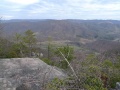
File:High Butte.jpg |Trail=Roaring Branch Trail(600 × 450 (71 KB)) - 22:19, 27 July 2020
File:Roaring branch trail profile.png |File name=roaring branch trail profile.png |Trail=Roaring Branch Trail(1,160 × 660 (22 KB)) - 22:30, 27 July 2020
File:Little stony creek falls profile.png |Trail=Little Stony Creek Falls |Caption=Trail Profile(1,160 × 660 (22 KB)) - 11:15, 19 January 2020
File:Lakeside Trailhead from Dam.jpg |Trail=Lakeside Trail(600 × 450 (104 KB)) - 20:11, 10 November 2019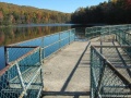
File:Lakeside Trail - Bays Mountain Dam.jpg |File name=Lakeside Trail - Bays Mountain Dam.jpg |Trail=Lakeside Trail(600 × 450 (84 KB)) - 20:14, 10 November 2019


