 Plans have been underway for over a year for the biennial celebration at ATC Cullowhee 2013. It will be held at Western Carolina University (WCU) July 19-26, 2013, in Cullowhee N.C. The five AT trail maintaining clubs in North Carolina, Georgia and Tennessee have been working on all aspects of this event. TEHCC is responsible for organizing the workshops while other clubs are handling volunteers, hike selection, excursions, entertainment, housing, etc. We expect near 1000 people to attend this week long event. Continue reading “A Biennial Celebration at ATC Cullowhee 2013”
Appalachian Trail Community designation event in Abingdon
 The Town of Abingdon joins the Appalachian Trail Conservancy and Mount Rogers Appalachian Trail Club in cordially inviting you to participate in the official designation of Abingdon as an Appalachian Trail Community™. This event will take place in Abingdon, VA on September 11th at 6pm at the Abingdon Farmer’s Market. Come out early to the Higher Education Center for a “Hikers and Bikers” presentation and hear from ATC’s Executive Director, Mark Wenger, about his Appalachian Trail section hike. The presentation begins at 4pm. We’d love to celebrate with you and hope to see you on Tuesday, September 11th!
The Appalachian Trail Community™ program recognizes communities who are taking extra steps to promote and protect the Appalachian Trail. Designation as an Appalachian Trail Community™ is intended to:
- Engage community residents, Trail visitors, and stewards
- Thank communities for decades of service to hikers
- Catalyze sustainable economic development
- Aid local municipalities and regional areas with conservation planning
- Raise local awareness of the Trail as a community resource and asset
Please RSVP by September 1, 2012 to Tenille Montgomery (tmontgomery@abingdon-va.gov) 276-676-2282.
Special AT Gravel Project on Round Bald, Trip Report
July 9-12. 2012
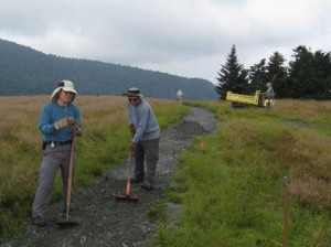 Last summer we hauled 37 tons of gravel from Carver’s Gap to between Round Bald and Engine Gap. This summer we hauled another 110 tons of ABC aggregate (crusher run) from Carver’s Gap to between Round Bald and Carver’s Gap.
Continue reading “Special AT Gravel Project on Round Bald, Trip Report”
Biennial Celebration at ATC Cullowhee 2013
AT: Hughes Gap to Little Rock Knob, Sunday August 26, 2012
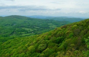 This hike is along the [[Iron Mountain Gap to Carver’s Gap|Appalachian Trail]] through hardwood forest to great views at Little Rock Knob (elevation 4918′). The round trip distance is 4.6 to 5 miles with 900’ rise (similar climb to Bays Mountain Firetower trail but over 3-4 times the distance). Let’s leave promptly at 1pm from the parking lot below [[Meeting locations for TEHCC hikes|McDonalds in Colonial Heights]] for the hour (45-mile) drive. Bring water, snack, comfortable footwear, rain gear, bug spray, and trekking poles. Expected return is by 7pm depending on our hiking speed and desire to tarry at the overlook. Please call/e-mail the hike leader for headcount to arrange transportation.
July Maintenance Reports
Reporting: Richard Carter
Date: 6/26/2012
Purpose: Cut weeds
Location: Section 14b, Stan Murray Shelter to one mile south of shelter
People: Richard Carter
Summary: I cut weeds with a string trimmer along approximately the first mile south of the shelter, removed one minor blowdown, and did some lopping of bushes.
Reporting: Steve Wilson
Date: 6/30/2012
Purpose: Cut weeds and briars
Location: Section 3a, Abingdon Gap Shelter to Spring 2.3 Mile North of Low Gap
People: Steve Perri, Steve Wilson
Summary: Scythes were used to cut weeds and briars on this 3.5-mile section. In spite of the dry weather, we found some stinging nettles were chest high and needed cutting. The trail and water diversions looked good. Water was found at the Abington Gap Shelter’s spring and at Double springs. We gave two thru hikers, Squirrel Fist and Lunatic, a ride to Damascus on our way home.
Reporting: Bill Berry
Date: 6/30/2012
Purpose: Cut weeds and clear blowdowns
Location: Section 20b, Temple Hill to No Business Shelter
People: Bill Berry
Summary: I cut weeds, blazed, and cleared blowdowns.
Reporting: Terry Oldfield
Date: 7/1/2012
Purpose: Maintain Mountaineer Falls Shelter
Location: Section 12b, Walnut Mountain Road to Mountaineer Falls Shelter
People: Terry Oldfield
Summary: I hiked with my daughters and trimmed a few overhanging branches on the way to the shelter from Walnut Mountain Road. At the shelter, we picked up trash and replaced the log book. I also picked up some trash at Walnut Mountain Road. Thanks to the Third-Saturday crew, the trail is in great shape and there wasn’t much trash to pick up.
Reporting: Carl Fritz
Date: 7/3/2012
Purpose: Cut blowdowns
Location: Section 2a, Backbone Rock Trail south for one mile
People: Carl Fritz, Bob Peoples
Summary: We used Backbone Rock Trail to access AT. We cut four blowdowns, the largest being just a couple of hundred feet from AT on Backbone Rock Trail.
Reporting: Carl Fritz
Date: 7/3/2012
Purpose: Clear relocation
Location: Backbone Rock Trail
People: Dave Clark, Jim Foster, Pat Loven, Ted Mowery, Ed Oliver
Summary: Tuesday Crew cut and lopped growth in the relocation that ASU will work on. Fourteen-hundred feet have been prepared with flags and divided into seven sections of 200 feet each.
Reporting: Bill Berry
Date: 7/6/2012
Purpose: Inspect trail and clear blowdowns
Location: Section 20b, Spivey Gap to No Business Shelter
People: Bill Berry
Summary: I inspected the trail and cleared blowdowns.
Reporting: Brian Paley
Date: 7/12/2012
Purpose: Clear blowdowns
Location: Section 8, Wilbur Dam Road to Watauga Shelter
People: Brian Paley, Bob Peoples
Summary: We cleared several large blowdowns caused by the recent storms.
Reporting: Brian Paley
Date: 7/17/2012
Purpose: Clear blowdowns
Location: Section 12d, North of US19E toward Bishop Hollow
People: Brian Paley, Jim Chambers
Summary: We cleared one regular blowdown, one 24-inch step-around log, and two large clusters of blowdowns.
Reporting: Carl Fritz
Date: 7/17/2012
Purpose: Inspect trail on Round Bald
Location: Section 14b, Engine Gap to Carvers Gap
People: Paul Benfield, Ken Buchanan, Pat Buchanan, Dave Clark, Carl Fritz, Frank Klein,
Ted Mowery, Ed Oliver, Bob Peoples
Summary: We inspected trail from Carvers Gap to Engine Gap and developed a plan for work to be completed with Konnarock Crew to hopefully finish major trail repairs to this section for twenty years. Four of us went to Banner Elk to purchase supplies including rebar for this project.
Reporting: Tim McClain
Date: 7/21/2012
Purpose: Cut weeds
Location: Section 3b, Spring to US421
People: Tim McClain, Peggy McClain
Summary: We cut weeds and cut back limbs and woody growth on the south half of this section.
Reporting: Tim McClain
Date: 7/22/2012
Purpose: Cut weeds and remove blowdowns
Location: Section 3b, Spring to US421
People: Tim McClain
Summary: I finished cutting weeds on this section and removed six small blowdowns with a handsaw.
Reporting: Richard Carter
Date: 7/22/2012
Purpose: Cut weeds
Location: Section 14b, North side of Grassy Ridge
People: Richard Carter
Summary: I cut weeds and briars with a string trimmer along about three-quarters of a mile of trail on the north side of Grassy Ridge.
Grants from Tennessee Appalachian Trail License Plate Revenue
Joe DeLoach reporting
 A committee consisting of members of the Tennessee Eastman Hiking & Canoeing Club, the Smoky Mountain Hiking Club, and the Appalachian Trail Conservancy (ATC) has been formed to advise the ATC on use of funds from the Tennessee Appalachian Trail license plate. Funds from this program must be used to support management of the Appalachian Trail in Tennessee and along the North Carolina border. Continue reading “Grants from Tennessee Appalachian Trail License Plate Revenue”
2012 Damascus Hard Core
Carl Fritz reporting
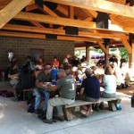
(photo courtesy of Steve Wilson)
The Damascus Hard Core event was Sunday, May 20th and Monday, May 21st. This is the largest trail maintenance event involving hikers on the entire Appalachian Trail. In spite of the obstacles, the hikers, club members and friends stepped up and volunteered in numerous ways to make this 12th annual outing a huge success. Continue reading “2012 Damascus Hard Core”
Special AT Gravel Project on Round Bald, July 9-12
Contact: Carl Fritz
Starting Monday, July 9 we will begin our probably-last big gravel project for the next decade. Last summer we moved about 37 tons of gravel to between Round Bald and Engine Gap. This year we want to move about 90 tons (5 truck loads) between Carver’s Gap and Round Bald. Continue reading “Special AT Gravel Project on Round Bald, July 9-12”

